

Published in SPOKES: June 2008
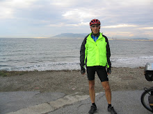
After cycling across the United States, circumnavigating Switzerland, and exploring Spain, I often wonder “where to” for my next cycling journey. Spokes’ editor suggested that I explore Virginia, my home state. What a novel idea! I have cycled the trails and roads in Northern Virginia and crossed the length of the southern part of the state—a long and hilly ride—when I cycled across the United States. Usually, I have been going “somewhere else” on my cycling trips. In the spring I took my first “cycling closer to home” trip into Virginia’s horse country.
Overview
Since I planed a local trip I decided to actually start cycling from home (no cars, trains, or planes on this trip) by taking the Washington & Old Dominion Rail Trail (W&OD) west out of the metropolitan area to Purcellville before hitting the roads. From there I planed to head south to Middleburg, The Plains, Marshall, and on to Warrenton. After that I would head northwest to Front Royal then head northeast to Paris (Virginia not France), Bluemont, and then back to Purcellville before hopping on the W&OD for the final leg home. I planned to cycle about 200 miles over 4 days.
My local cycling friend Larry and his cycling friend Dave from York, Pennsylvania decided to join me. Larry wanted to try his new recumbent on a tour and Dave wanted a shake-down ride in preparation for his upcoming ride from Astoria, Oregon to his home in PA.
I used Google Maps to find a route that consisted of mostly country roads with low traffic volume. I knew that the terrain would be hilly so I did not even look at that feature of the program. I left home with a print-out of the narrative directions but wished that I had also printed the larger sections of the detailed maps. The level of detail on Google was greater than the state road map that I carried. It would have been helpful to connect the narrative with a map to avoid some of the confusion we had at several unmarked country roads.
Google is also helpful in finding lodgings, restaurants, and bike shops. If you want a Bed and Breakfast you will have no trouble finding lots of accommodations along this route. However, motels are only found in Leesburg, Warrenton, and Front Royal. By using B&Bs you will have greater flexibility in controlling the length of your riding days. Restaurants, cafés, and other food stops are found in all the towns that we cycled through.
Heading West on the W&OD

Our trip started in less than ideal conditions. The weekend weather prior to start of our trip was a torrential downpour. Despite the continuing rain, we started our journey on a very wet Monday. However, we anticipated better weather for the rest of the week as we left Falls Church (mile 7 on the W&OD trail) and headed west. Surprisingly, we encountered other foul-weather cyclists, joggers, walkers, etc. on the trail. With all the rain a section of the trail near Leesburg was flooded and closed; necessitating a detour onto the roads. Otherwise the trail was in good condition and riding to the end in Purcellville was easy. The W&OD railroad first ran to Purcellville in 1871 but terminated operations in 1968 and later becoming a rail tail.
On the Roads
Purcellville has several restaurants in this part of town. Just make a left off the W&OD onto N. 21 St. and go to Main St. While we were having coffee in Purcellville, one local resident told us that they see lots of cyclists on route VA-690 heading towards Middleburg and that most drivers took their time passing the bicyclists. We had no trouble with the cars and made several stops to look at the wildflowers and horses. We were still on the fringe of “horse country” but my untrained eye saw lots of good looking horses.
Falls Church to Middleburg: 55 miles

W&OD Trail to Purcellville
Left onto N. 21 St.
Left at Main St. (Route 7)
Immediate right at Nursery Ave (VA-690)
Left at S 32nd St. (continuing on VA-690)
Cross Snickersville Turnpike and VA-690 becomes VA-611
Left on Foxcroft Rd to Middlesburg.
We arrived in Middleburg in time for lunch. Middleburg was established in the late 1700s and supposedly got its name because it was midway between Alexandria and Winchester. This little town has several good meal options ranging from a grocery store bag lunch to fine dining. We chose a café called Mello Out on E. Federal St. and had interesting sandwiches and drinks while we relaxed and listened to several local horse owners talk about the trials and tribulations of owning a horse. Based on what they said, we were thankful that we only had bicycles to contend with. You may want to plan your cycling trip to Middleburg to take advantage of its horses, fox hunting, and steeplechases. Or plan your trip for May when the town hosts the “Hunt Country Stable Tour.” I took this tour several years ago and was amazed at how well the horses lived. In fact, one stable even had a swimming pool for its horses.
Middleburg to Warrenton: 30 miles 
Right on US-50
Left on VA-626 to The Plains
Right on VA-55 to Marshall
Left on US-17
Right at Carters Run Rd.
Left at Wilson Rd
Left at Cannonball Gate Rd.
Continue on Bear Wallow Rd
Right at Norfolk Dr.
Left at Gold Cup Dr. into business district
Next, we headed south to The Plains. The W&OD was flat but the further south we got the more rolling hills we cycled. None of them were difficult and the change of pace was nice. We were now in the heart of Virginia’s horse country which made stopping by the side of the road very enjoyable. We also noticed that the number of wineries was increasing as we headed south. It would be fun to plan a cycling trip that incorporated stops at several of them. In hindsight I wondered why I chose to tour the horse country and not the wine country.
The Plains is a very small town but you won’t go hungry as the town has several cafés where cyclists are welcome. In The Plains we met a man interested in our ride. While in his professional life he is a mine inspector, his and his wife’s passion is competing in long distance cycling races. We were definitely not racing since we only averaged 12 mph. However, as with most cyclists we found a common bond as we swapped cycling stories.
From the Plains we headed about 5 miles west to Marshall. In case you are wondering, Marshall got its name from our first Chief Justice, John Marshall. If you did not want to do a horse or wine tour of this area, you could do a history tour. Many of these towns were founded in the 1700’s and later saw action during the Civil War.
Our First Climb
Leaving route VA-55 we headed south for a short distance on Winchester Road (US-17). While this highway has more traffic it also had a shoulder. Just after crossing over Route 66 we made a right turn onto Carters Run Rd and quickly into the calm of another good country road. This was great cycling until we neared Warrenton and had to climb Viewtree Mountain. While the climb was only several hundred feet in elevation, it was steep. I rationalized that a short walk would do my legs good and ended up pushing my bike up the steepest part. Since Dave and Larry were also walking, they must have wanted to stretch their legs as well.
One of Warrenton’s “claims to fame” is that it hosted Virginia’s first Gold Cup Race in 1922. Like most towns we visited, Warrenton has maintained its historic district with many early American buildings still intact. That is amazing considering that during the Civil War the town “changed hands 67 times.”
Warrenton to Leesburg: 75 miles
Left from Gold Cup Dr. at Blue Ridge St.
Right at Waterloo Rd
Continue on Old Waterloo Rd
Left at Old Waterloo Rd
Right on Leeds Manor Rd
In Hume, left on Hume Rd
Right on Fiery Run Rd
Stay on Fiery Run Rd (several miles of unpaved surface)
Right at VA-55
Left at VA -688
Left at US-17
Left on US-50
Right on VA-601 Blueridge Mountain Rd
Right on VA-7 at Snickers Gap to Purcellville
Left on 21 St
Right on W&OD to Leesburg
Getting Lost is Part of the Adventure
We left Warrenton early in the morning and experienced some traffic getting out of town. But within a few miles the traffic disappeared and we were again cycling on country roads. Before we got to Hume we found a café and stopped for a break. After we got on the road again we were thankful for the stop because we did not find another place until we reached VA-55. While we had originally planned to go into Front Royal we got confused when we reached Fiery Run Road. Where was the detailed Google map when I need it? We should have gone straight because Hume Road became Fiery Run Road going west but we chose to go right on Fiery Run Road heading north. If we had gone straight on Hume Rd it would have taken us to US-522. From there we would have made a right and headed north into Front Royal. However, our right turn on Fiery Run Road took us directly to VA-55 but over several miles of unpaved road. Yes, that became just another part of the “adventure.”
Front Royal is the gateway to the Shenandoah’s with access to Skyline Drive, Shenandoah National Park, and the Shenandoah River. However, I later learned from the town’s web page that by missing Front Royal I missed a great piece of baseball trivia. The Front Royal Cardinals play in the Bing Crosby Stadium; named for the singer because of his donations of land and money.
After turning onto VA-55, we passed a crossing for the Appalachian Hiking Trail that would run parallel to our ride north on VA-688 and VA-601. Dave recently hiked the entire trail and Larry has hiked a good portion of it.
Always Another Climb
After leaving VA-55 we encountered our first big climb of the day. We headed north on VA-688 toward Paris and had a 600 foot climb over the mountain. We reached this point in our trip after cycling 35 miles over rolling hills and on dirt roads. However, it was very scenic with farms and more horses along the way. We also passed the 4,000 acre Thompson State Wildlife Management Area (which hosts 7 miles of the Appalachian Trail) and the Green’s Mill site (the mill was built between 1818 and 1823). What bothered us was that we knew that we had another climb facing us as we cycled up Blueridge Mountain Road.
The Blueridge Mountain Road climb seemed steeper and the 3 of us ended up walking our bikes up the worst part as we swatted away the mosquitoes and gnats. Once we got back on our bikes we cycled for several miles along the top of the ridge before heading down to route VA-7. We had been paralleling the Appalachian Trail during most of this climb and hoped to stop at the nearby hostel. However the hostel was about half way down the mountain and we chose not to interrupt our great down-hill ride. Once we hit VA-7, we literally had a long down hill ride all the way to Leesburg--about 20 blessed miles!
We reached Leesburg after cycling 75 miles on loaded bikes and climbing 2 big hills. Surprisingly, we all felt that we could continue the rest of the way home. However, we had reservations to stay in Leesburg and decided to keep to our original plan. While all the towns we visited were very nice, Leesburg has always been one of my favorite towns. I like the feel of the town, its historic district, great restaurants, and bike shops. The town also has horses, wineries, and was the home of George Marshall of WWII fame.
The next morning was just a short-flat ride of 26 miles on the W&OD trail. Within a few hours I arrived home in Falls Church.

Right on US-50
Left on VA-626 to The Plains
Right on VA-55 to Marshall
Left on US-17
Right at Carters Run Rd.
Left at Wilson Rd
Left at Cannonball Gate Rd.
Continue on Bear Wallow Rd
Right at Norfolk Dr.
Left at Gold Cup Dr. into business district
Next, we headed south to The Plains. The W&OD was flat but the further south we got the more rolling hills we cycled. None of them were difficult and the change of pace was nice. We were now in the heart of Virginia’s horse country which made stopping by the side of the road very enjoyable. We also noticed that the number of wineries was increasing as we headed south. It would be fun to plan a cycling trip that incorporated stops at several of them. In hindsight I wondered why I chose to tour the horse country and not the wine country.
The Plains is a very small town but you won’t go hungry as the town has several cafés where cyclists are welcome. In The Plains we met a man interested in our ride. While in his professional life he is a mine inspector, his and his wife’s passion is competing in long distance cycling races. We were definitely not racing since we only averaged 12 mph. However, as with most cyclists we found a common bond as we swapped cycling stories.
From the Plains we headed about 5 miles west to Marshall. In case you are wondering, Marshall got its name from our first Chief Justice, John Marshall. If you did not want to do a horse or wine tour of this area, you could do a history tour. Many of these towns were founded in the 1700’s and later saw action during the Civil War.
Our First Climb
Leaving route VA-55 we headed south for a short distance on Winchester Road (US-17). While this highway has more traffic it also had a shoulder. Just after crossing over Route 66 we made a right turn onto Carters Run Rd and quickly into the calm of another good country road. This was great cycling until we neared Warrenton and had to climb Viewtree Mountain. While the climb was only several hundred feet in elevation, it was steep. I rationalized that a short walk would do my legs good and ended up pushing my bike up the steepest part. Since Dave and Larry were also walking, they must have wanted to stretch their legs as well.
One of Warrenton’s “claims to fame” is that it hosted Virginia’s first Gold Cup Race in 1922. Like most towns we visited, Warrenton has maintained its historic district with many early American buildings still intact. That is amazing considering that during the Civil War the town “changed hands 67 times.”
Warrenton to Leesburg: 75 miles

Left from Gold Cup Dr. at Blue Ridge St.
Right at Waterloo Rd
Continue on Old Waterloo Rd
Left at Old Waterloo Rd
Right on Leeds Manor Rd
In Hume, left on Hume Rd
Right on Fiery Run Rd
Stay on Fiery Run Rd (several miles of unpaved surface)
Right at VA-55
Left at VA -688
Left at US-17
Left on US-50
Right on VA-601 Blueridge Mountain Rd
Right on VA-7 at Snickers Gap to Purcellville
Left on 21 St
Right on W&OD to Leesburg
Getting Lost is Part of the Adventure
We left Warrenton early in the morning and experienced some traffic getting out of town. But within a few miles the traffic disappeared and we were again cycling on country roads. Before we got to Hume we found a café and stopped for a break. After we got on the road again we were thankful for the stop because we did not find another place until we reached VA-55. While we had originally planned to go into Front Royal we got confused when we reached Fiery Run Road. Where was the detailed Google map when I need it? We should have gone straight because Hume Road became Fiery Run Road going west but we chose to go right on Fiery Run Road heading north. If we had gone straight on Hume Rd it would have taken us to US-522. From there we would have made a right and headed north into Front Royal. However, our right turn on Fiery Run Road took us directly to VA-55 but over several miles of unpaved road. Yes, that became just another part of the “adventure.”
Front Royal is the gateway to the Shenandoah’s with access to Skyline Drive, Shenandoah National Park, and the Shenandoah River. However, I later learned from the town’s web page that by missing Front Royal I missed a great piece of baseball trivia. The Front Royal Cardinals play in the Bing Crosby Stadium; named for the singer because of his donations of land and money.
After turning onto VA-55, we passed a crossing for the Appalachian Hiking Trail that would run parallel to our ride north on VA-688 and VA-601. Dave recently hiked the entire trail and Larry has hiked a good portion of it.
Always Another Climb
After leaving VA-55 we encountered our first big climb of the day. We headed north on VA-688 toward Paris and had a 600 foot climb over the mountain. We reached this point in our trip after cycling 35 miles over rolling hills and on dirt roads. However, it was very scenic with farms and more horses along the way. We also passed the 4,000 acre Thompson State Wildlife Management Area (which hosts 7 miles of the Appalachian Trail) and the Green’s Mill site (the mill was built between 1818 and 1823). What bothered us was that we knew that we had another climb facing us as we cycled up Blueridge Mountain Road.
The Blueridge Mountain Road climb seemed steeper and the 3 of us ended up walking our bikes up the worst part as we swatted away the mosquitoes and gnats. Once we got back on our bikes we cycled for several miles along the top of the ridge before heading down to route VA-7. We had been paralleling the Appalachian Trail during most of this climb and hoped to stop at the nearby hostel. However the hostel was about half way down the mountain and we chose not to interrupt our great down-hill ride. Once we hit VA-7, we literally had a long down hill ride all the way to Leesburg--about 20 blessed miles!
We reached Leesburg after cycling 75 miles on loaded bikes and climbing 2 big hills. Surprisingly, we all felt that we could continue the rest of the way home. However, we had reservations to stay in Leesburg and decided to keep to our original plan. While all the towns we visited were very nice, Leesburg has always been one of my favorite towns. I like the feel of the town, its historic district, great restaurants, and bike shops. The town also has horses, wineries, and was the home of George Marshall of WWII fame.
The next morning was just a short-flat ride of 26 miles on the W&OD trail. Within a few hours I arrived home in Falls Church.
No comments:
Post a Comment