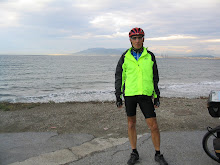

After each of my cycling trips, I am asked questions like,
“how was it” or “what part did you like the best.” My
answer is usually, “fantastic” followed up by a couple of good stories. In some ways this trip had some real
challenges that, at the time, seemed to overwhelm the many great things we
experienced. It took me a while to
decide how I could characterize this adventure without the tough parts
dominating the story. After some
contemplation, I thought of the title of Clint Eastwood’s epic spaghetti
western, “The Good, The Bad, and The Ugly” and it seemed to fit our trip.
The GOOD
When Joe and I got off the train in Havre, Montana (the end
of our 2009 trip) it was raining heavily (it was ugly) and my bike was missing
(that was bad). Both of these events
could have a real damper on any cycling trip.
However, spending an extra day waiting for my bike allowed 3 good things
to happen. First, because we were unable
to start cycling we avoided the heavy rains that fell the next morning and into
the mid-afternoon. Second, we visited
Havre’s tourist attractions. Third, our
friend, Hans-Peter who was cycling from the Pacific Ocean to Bar Harbor, Maine,
met us in Havre the next day.

The town dates back to late 1800 when it started as a rough
and tumble railroad and military town with few women but lots of bars and
brothels. A fire in 1904 destroyed five
blocks of its business district. The
businesses soon reopened in their remaining basements and continued to operate underground
even as the town was rebuilt above them, thus Havre Underground. As the city above was rejuvenated, clear
glass blocks were installed in the sidewalks to allow light into the
underground. As the glass blocks aged
they turned purple, creating an interesting underground mosaic. The recreated underground businesses include a
brothel, bars, dental office, drug store, meat market, law office, bakery,
laundry, and opium den. While no
brothels or opium dens were visible during our above-ground tour of Havre, the
town still seems like it has a rough edge with lots of bars and casinos.
Our next tourist stop was the “Buffalo Jump,” about 8 miles
from Havre. The Buffalo Jump got its
name from the Native American practice of stampeding buffalo over a cliff so
meat and hides could be harvested. The site dates back 2,000 years and was
preserved as the hillside collapsed and covered the remains. In the late 1960s, archaeologists began
uncovering 3 distinct layers of activity.

Hans-Peter arrived later in the day. That evening we cycled to one of Havre’s
restaurants that overlooked the town.
There, we enjoyed swapping stories over dinner and beers.
Several days after leaving Havre, we had a string of good
days. From Great Falls we headed
southwest on an old highway that was devoid of traffic as it paralleled the Interstate.
We headed towards picturesque mountain ranges.
While the closer mountains were scenic, behind them sat even larger snowcapped
mountains that caught our attention. Pronghorn
antelopes were in the fields and raced us as we moved westward. When we reached the town of Cascade, we
stopped at the newly remodeled Cascade Coffee and Café where the owner and her short-order
chef served us great food and warn hospitality.
 Leaving Cascade, we cycled along the Missouri River. The terrain slowly changed and became hilly
as we approached Tower Rock State Park, noted in Meriwether Lewis’
journal as “The Tower.” Lewis reported that he climbed the 400 foot rock with
some difficulty but from there saw a pleasing view of the country…and immense
herds of buffalo in the plains below. Just
past the Park we could see the nearby Interstate climb up into the mountains. However, we continued on our county road that
ran alongside the river avoiding a big climb and providing us with a scenic ride. Following the Missouri River, we soon entered
a canyon that snaked through sheer cliffs for about 15 miles of cycling bliss. We ended the day at the “town” of Wolf Creek
that provided us good lodging and meals.
The town, however, wasn’t much more than several outfitters, 2 motels
(only one still in business), a post office, 2 bars, a few homes and a church.
Leaving Cascade, we cycled along the Missouri River. The terrain slowly changed and became hilly
as we approached Tower Rock State Park, noted in Meriwether Lewis’
journal as “The Tower.” Lewis reported that he climbed the 400 foot rock with
some difficulty but from there saw a pleasing view of the country…and immense
herds of buffalo in the plains below. Just
past the Park we could see the nearby Interstate climb up into the mountains. However, we continued on our county road that
ran alongside the river avoiding a big climb and providing us with a scenic ride. Following the Missouri River, we soon entered
a canyon that snaked through sheer cliffs for about 15 miles of cycling bliss. We ended the day at the “town” of Wolf Creek
that provided us good lodging and meals.
The town, however, wasn’t much more than several outfitters, 2 motels
(only one still in business), a post office, 2 bars, a few homes and a church.
Days later, in Lolo Hot Springs, Montana, we were “treated”
to a concert so it must fit the “good” category. One of the first things we did upon our
arrival was relax in the hot springs. Later,
we went to the bar for our meal and were immediately thrown into a time
warp. When making our reservations we
were told that a “pirate concert” would be happening just across the highway
from our lodge. Neither of us took this
warning too seriously. We still don’t know what a pirate concert is, but the
clothing the kids were wearing was a direct throwback to the 1970s. The guys were skuzzy and the girls half
dressed. Yes, we are officially old (which
may be bad but does give us time to take cycling trips). Furthermore, the music was nothing we could
relate to. It was a throbbing bass that
literally vibrated our motel room that was 300 yards away from the stage.
We left at dawn the next morning accompanied by the
continuing loud music and a barrage of fireworks that sailed into the air in
our honor…at least that is what we believed.
We climbed a long, but easy, incline for about an hour before the road
got steeper as we crossed over Lolo Pass at 5,233 feet. It was a relatively easy climb but the
temperatures were in the mid-thirties and we were cold. Next, we had a fast 5 mile downhill ride that
took us to Powell, Idaho were we stopped for breakfast. (In 2002, we camped here when we cycled
across the United States.) Powell is not
a town but rather a ranger station with a camp ground, cabins, and a great
restaurant. As we turned off the highway, we met Reinhare a cyclist from
Germany and joined him for breakfast. Reinhare
was cycling from Portland, Oregon to Portland, Maine. Our breakfast was excellent but too much for
us to consume, which was good because it provided 2 large huckleberry pancakes
for lunch.
The rest of the day, we enjoyed a gradual decline, as we
followed the Lochsa River for the next 70 miles. This was the beginning of
several fantastic days. As we continued
westward, we met more cyclists. Becky
and Denis were cycling home to Delaware and were only 7 days from their start
in Portland, Oregon. While we recommended the restaurant in Powell, they warned
us that all we had to look forward to were fried foods and hamburgers until we
got closer to Portland.
 The Lochsa River is scenic and fast moving. It races over
rocks and around sharp bends through a valley of pine trees and steep hills. Along
the way we saw many white water rafters which provided us with a great
diversion. We would race ahead of the rafts to a good spot for photographs and
after they passed we would race to the next spot for more pictures. With our racing, the heat and head winds, we
found ourselves low on drinking water.
But, as the old saying goes, “the road provides,” and one of the raft
group support vehicles had plenty of water to share.
The Lochsa River is scenic and fast moving. It races over
rocks and around sharp bends through a valley of pine trees and steep hills. Along
the way we saw many white water rafters which provided us with a great
diversion. We would race ahead of the rafts to a good spot for photographs and
after they passed we would race to the next spot for more pictures. With our racing, the heat and head winds, we
found ourselves low on drinking water.
But, as the old saying goes, “the road provides,” and one of the raft
group support vehicles had plenty of water to share.
At Three Forks, the Lochsa River merged with the Selway
River and later the Clearwater River. The
river became less wild as it became wider and calmer but we were still faced
with a constant head wind. As we entered
Orofino, Idaho, we saw a new motel across the river that was not on our list of
lodgings. While our “planned” lodging
was 2 miles further downriver, we could not pass up a new motel. The
rate matched the prevailing rate on this trip but we got a much better lodging
than most nights. When we entered the
lobby, Courtney, the manager, greeted us with bottles of cold water, and a warm
smile. Another woman, who introduced
herself as the breakfast hostess, asked if we planned to leave early the next
day. When we told her that we did, she
said she would have breakfast ready earlier than scheduled. Sure enough, at 5:30 the next morning we had
fresh coffee, real eggs, sausages, etc., and a wonderful start to our day. Now that was good!
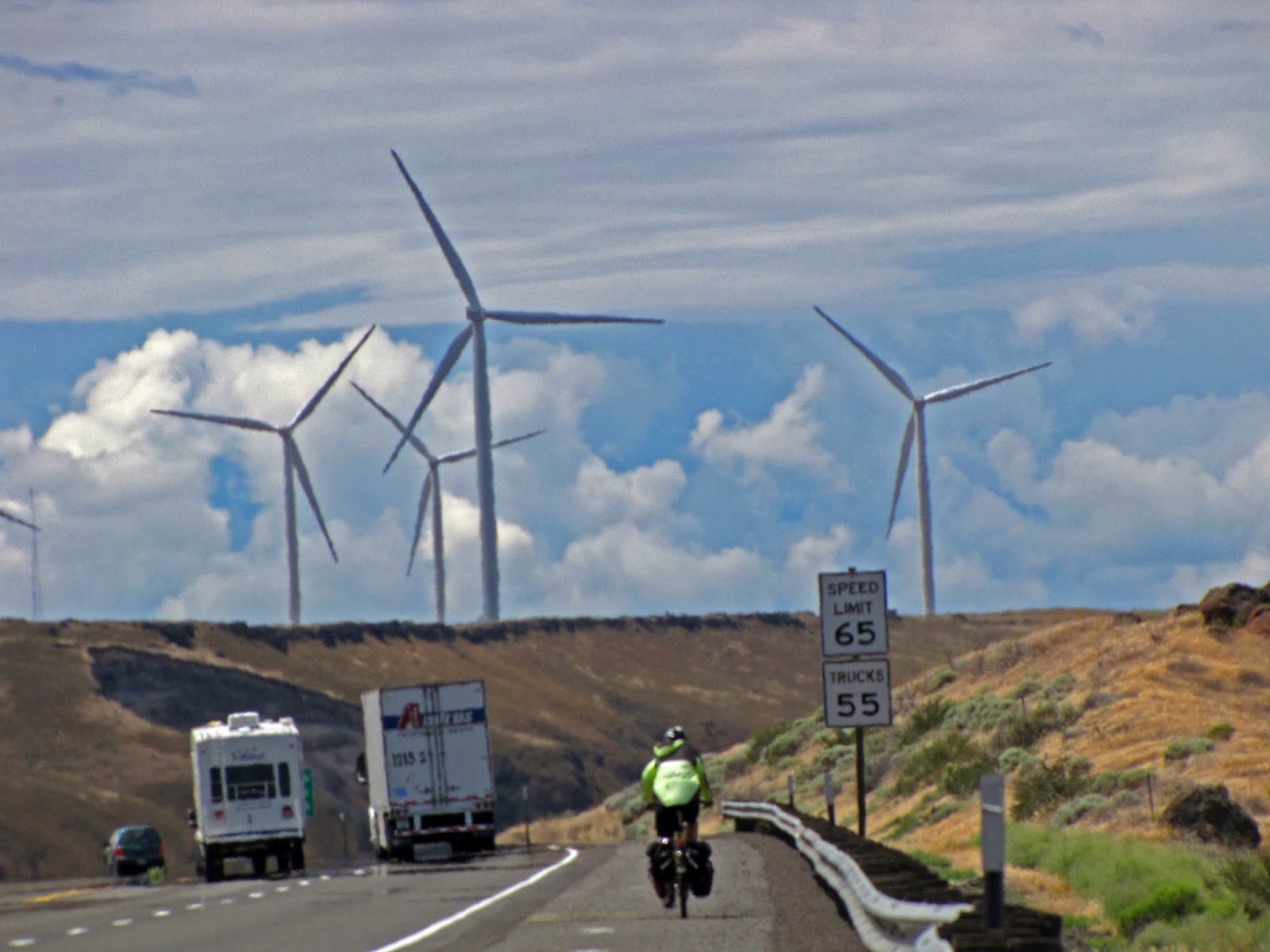
Sometimes, those ugly head winds actually produced good
results. We had been leaving early to
avoid the head winds that start as the day warms. Leaving Pomeroy, Washington we encountered 20
to 25 mph winds out of the south west. It
was ok for awhile because we were not headed directly into the wind and had a
15 mile gradual downhill. However, when
our direction changed directly to the southwest, things got tough. As if the steady winds were not bad enough,
the gusts were much stronger and occasionally blew us off the road. (We learned
later that the gusts were 30 to 40 mph.)
We finally arrived in Dayton, Washington, and decided to stop for the
day.
 Dayton is a real gem that we would have missed if we
continued with the day’s planned mileage.
Not to waste the day, we took a walking tour of Dayton, which dates back
to 1860. Dayton’s downtown has not only
survived but appears to be thriving. In
addition to our motel (another new Best Western), we found several nice
restaurants, a brew pub, several cafes, the usual bar and pizza places, several
stores, art galleries, and antique shops. We also saw the historic county courthouse
and the restored train station--built in 1881 by the Oregon Railroad and
Navigation Company and is the oldest surviving train station in
Washington.
Dayton is a real gem that we would have missed if we
continued with the day’s planned mileage.
Not to waste the day, we took a walking tour of Dayton, which dates back
to 1860. Dayton’s downtown has not only
survived but appears to be thriving. In
addition to our motel (another new Best Western), we found several nice
restaurants, a brew pub, several cafes, the usual bar and pizza places, several
stores, art galleries, and antique shops. We also saw the historic county courthouse
and the restored train station--built in 1881 by the Oregon Railroad and
Navigation Company and is the oldest surviving train station in
Washington.
During our walk we
decided to check out each of the restaurant’s dinner menus. We stopped first at the Fire and Irons
Brewpub and sampled several beers. Next
we wandered into the Manila Bay Asian Café that required reservations and had
some very interesting but expensive menu items. Near the end of our walk we
found Weinhard Café and went back there for dinner. Dinner started with local beers, cream of
asparagus soup, mixed green salad and their own flat bread with a chickpea and
radish spread. For our main course we
each had fresh halibut over a bed of rice topped with green curry sauce and a
side of asparagus spears. For dessert
Joe had pecan pie and I had the black berry cobbler. The menu changes daily and the breads and
desserts are all “house made.” This was a fantastic meal and a far cry from the
ever-prevalent hamburgers and fried chicken.
 For several days, we had to cycle on the Interstate Highway
that ran next to the Columbia River. It
should have been scenic but with the traffic noise and headwinds we just wanted
to pound out the miles and get to The Dalles, Oregon. This is where the Gorge transitioned from
high desert to a rainforest environment.
Leaving The Dalles, we cycled on
a trail that took us west along the Columbia River. While the trail was paved, it was more of a
nature trail; meandering with lots of
twists and turns meant to give the trail user a look at the flora and fauna
that grows in the marsh along the river.
From there we got on Historic Route 30, a rarely used road that goes
into the mountains overlooking the river.
Parts of this route are closed to motorized vehicles which was
good. It also
For several days, we had to cycle on the Interstate Highway
that ran next to the Columbia River. It
should have been scenic but with the traffic noise and headwinds we just wanted
to pound out the miles and get to The Dalles, Oregon. This is where the Gorge transitioned from
high desert to a rainforest environment.
Leaving The Dalles, we cycled on
a trail that took us west along the Columbia River. While the trail was paved, it was more of a
nature trail; meandering with lots of
twists and turns meant to give the trail user a look at the flora and fauna
that grows in the marsh along the river.
From there we got on Historic Route 30, a rarely used road that goes
into the mountains overlooking the river.
Parts of this route are closed to motorized vehicles which was
good. It also had some climbs but we enjoyed the vistas and lack of traffic that took us into Hood River, Oregon.

From Cascade Locks we again cycled on a bike path that took
us west along the Interstate for about 5 miles.
From there, we had to get on the Interstate for only 3 miles before
transitioning back to “Historic Route 30” that took us by many large water
falls. Most notable is the Multnomah
Falls, the highest waterfall in the Columbia River Gorge with a total drop of
620 feet. Later, we had a long climb up
to Vista House that was above the clouds (not that we were so high but the
clouds were low over the river) and offered a wonderful view of the Columbia
River and valley below. As we continued
west, we cycled along the top of the ridge for several miles before we came to
the long anticipated downhill that dropped us back to the river and led us into
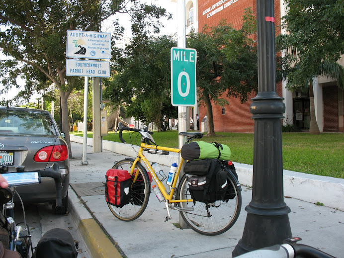
Portland, Oregon. As we worked our way
into the city, we cycled mostly on bike paths along the Columbia River with
Mount Hood looming behind us. Once we
got into the city, we headed for the River City Bike shop where we left our
bikes to be shipped home.

THE BAD
After reading about the good, you may not be sympathetic
about the “bad” we encountered. But one day was truly bad and cannot be
ignored. In Fort Benton, Montana, we
woke to heavy rains and cold temperatures and contemplated staying in our motel
for another day. However, we thought we
could tough out the weather but it really punished us. The temperature stayed in the low 50s and the
wind blew the rain under our protective gear making us wet and cold. We worried about hyperthermia and there was
no place to get out of the weather—no gas station, restaurant, roadside
shelter—so we just had to push on to Great Falls, Montana, 43 miles away. At the first motel we found, we took long hot
showers, enjoyed several hot drinks, and blasted the heat in our room. Surprisingly,
several days later as we were again battling headwinds up a 2 mile climb (near
Helena, Montana) we met Marlowe Rames who had a different perspective to our bad
day. Marlowe told us he wanted to talk
to us because he saw us cycling in the rain on the road to Great Falls. He told us how tough he thought we were
cycling in such bad weather and wished he had the determination to do what we
did. Gee, we thought that we were just
stupid.
THE UGLY
 I have made several references to the head winds we
encountered on this trip. Let me get
this over with quickly. We had head winds during most of our trip and some days
they were downright challenging. Before
undertaking this journey, we checked into the common belief that the winds are
predominately from the west. What we
found out was that the trade winds are from the west but they are thousands of
feet in the air pushing airliners east.
Surface winds, however, are “usually” from the south; except in the
Columbia River George which acts like a wind tunnel.
I have made several references to the head winds we
encountered on this trip. Let me get
this over with quickly. We had head winds during most of our trip and some days
they were downright challenging. Before
undertaking this journey, we checked into the common belief that the winds are
predominately from the west. What we
found out was that the trade winds are from the west but they are thousands of
feet in the air pushing airliners east.
Surface winds, however, are “usually” from the south; except in the
Columbia River George which acts like a wind tunnel.
The winds up the Columbia River Gorge were as bad as
predicted but they weren’t the worst and most days the winds came from the
west; so much for our research. At the
end of one of our particular tough days we received an email from our friend
Hans-Peter. As you will recall, he was
heading east and we were going west.
Hans-Peter complained that the headwinds were also keeping him from
moving. We wondered how it could be that
the east bound cyclist and west bound cyclist both have head winds. The old cyclist’s adage must be true, “no
matter which way you are heading, you will have a headwind.”
THE END