Friday, November 18, 2011

Ice Cream and the Pine Creek Trail

(Published in SPOKES, April 2012)

Photos by Joseph Insalaco

Most cyclists know of the relationship between miles pedaled and ice cream consumption. In fact, it was an ice cream story that introduced me to the Pine Creek Trail. In the spring of 2011, my friend Larry told me about the fantastic ice cream he recently enjoyed. It was only when I asked him where he had this ice cream, did I learn about the fantastic trail ride that led to his dairy delight.

Who couldn’t resist ice cream and a great trail? Early in the fall, my friend Joe and I decided to share in Larry’s experiences and drove to the Pine Creek Trail. The trail is located in north central Pennsylvania just northwest of the city of Williamsport. Its northern end starts near the town of Wellsboro and its southern end is in the town of Jersey Shore. The trail is a 60-mile long former railroad right-of-way with a 2% grade on a hard- packed gravel surface.

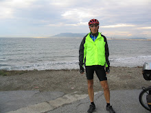
Joe (from New York) and I (from Virginia) met near the middle of the trail at the Cedar Run Inn (www.cedarruninn.com) to start our ride and seek out “the” ice cream.
The Cedar Run Inn, built in 1891, is now a bed and breakfast with 13 guest rooms (some with private baths). The inn is located next to the trail and just across the street from the general store that sold Larry his ice cream. Larry was definitely onto something. When I arrived at the inn, I saw many people with large double scooped cones relaxing from their time on the trail. Joe also was there waiting for me with ice cream in his hand. Besides great ice cream and fine lodging, this location provided us with a great place to watch a bald eagle sore over the creek. The inn is located in the “middle of no where” and offers serenity not found in our normal congested urban living environments. While we did not have cell service, both the inn and general store had payphones—old technology that seems to be disappearing everywhere else but valued at Cedar Run.


The trail originated as a Native American path that followed Pine Creek. As the area was settled, lumbering became its major industry and by 1840 there were a reported 145 sawmills along the creek. The creek was used to float logs down stream to the saw mills. In the late 1800s, the Jersey Shore, Pine Creek and Buffalo Railway completed laying its tracks and began service along the Native American trail. Primarily, the railway carried lumber from the many sawmills to markets. After a series of reorganizations, the railroad along Pine Creek became part of the New York Central Railroad and eventually Conrail. Freight and passenger service continued until 1988 when Conrail ended rail service along Pine Creek. The tracks were eventually removed and the first section of the Pine Creek Rail Trail opened in 1996. The trail was completed in stages with the most recent section (from Ansonia to just north of Wellsboro) being completed in 2007. The trail is operated by the Pennsylvania Department of Conservation and Natural Resources.

While the Cedar Run Inn is near the center of the trail, we decided to cycle the trail from end to end. To get to the northern end of the trail we cycled northeast from Cedar Run via state route 414 to the town of Morris then headed north on state route 287. Route 414 had no shoulder but was virtually deserted. Route 287 had traffic but a reasonable shoulder. We could have avoided route 287 by cycling Stony Fork Road. Stony Fork Road was clearly visible on the other side of a wide and knee deep creek along route 414. However, these roads were not connected by a bridge. To get to the Stony Fork Road we would have had to carry our bikes through the stream. Afterwards, we anticipated several steep climbs on this route.


We still had a long, but relatively easy climb on route 287 to get to the town of Wellsboro. Just south of Wellsboro, at the top of the mountain, we stopped at William Schlegel’s studio. Mr. Schlegel is a wood sculptor/carver. He gave us a tour of his studio and showed us his current carved animal projects including a bear, beaver, and an eagle. He starts his wood carvings with a chain saw and then uses a small hand tool for the finish work.


Leaving Mr. Schlegel’s studio, we had a 2.5 mile drop into the small but vibrant town of Wellsboro. The town founded in the early 1800s has a population of just over 3,000. Despite its small population, its downtown is lively with many shops, motels, and places to eat. We ate lunch at the historic Wellsboro Diner. This restaurant is an authentic diner dating from 1939. While the diner was old, its food was great with home made soups, pies, and cookies…we tried all 3. Wellsboro also offers a bike shop and several outfitters that rent bikes, canoes, and kayaks. We had planned to kayak on Pine Creek but were told that the creek’s water level was too low. The outfitter suggested that we come back in the early spring when water levels offer great kayaking. Also, just a few miles from Wellsboro is one of Pennsylvania’s largest wetland complexes called “The Muck” that offers bird observation blinds that are open year round. In addition, Pine Creek is a very popular place for fly fishing.


Leaving Wellsboro we headed north on route 6 to the Pine Creek’s northern trail head. Across the road from the trail head we first stopped at the Tioga Central Railroad (www.tiogacentral.com) which operates on a right-of-way that dates to 1840.
The railroad offers excursions on vintage rail cars. There was also a restaurant at the trail head…the only place to eat along the trail until you reach Cedar Run. (If planning to cycle the trail note that the Cedar Run Inn only serves food on the weekends and the country store is also open only on the weekends. To obtain food during the week you will need to cycle 5 miles further south to Slate Run.)

Cycling was easy on the trail’s hard packed gravel surface. We quickly left civilization as the trail meandered through marshes and farm lands and headed into the Pine Creek Gorge. The glacially-carved gorge is about 12 miles from the trail’s northern terminus.
The northern section of the gorge is known as the Grand Canyon of Pennsylvania. After visiting the Nation’s Grand Canyon in Arizona, I would not use the term “grand canyon” to describe this gorge. However, it is a wonderful gorge in a narrow valley with only the trail and creek on its floor. Both sides of the valley are steep, tree covered hills. The deepest point of the gorge is 1,450 feet and while it is mostly narrow, one part does spread out to nearly 1 mile in width. As we cycled through this narrow valley, we enjoyed the creek and we wondered how the gorge would look in just a few weeks as the leaves took on their fall colors and how the creek would look in the spring when it flow increases dramatically.

Access to the gorge appeared to be limited. While we did not see any roads or parking lots, the Department of Conservation and Natural Resources’ map shows 2 roads entering the park from the north and east. We did share the trail with horse pulling 2 Conestoga wagons. These wagons offered a great way to experience the gorge and were full of tourists. Each wagon had a narrator describing the areas history and resources.

Since we were cycling on a weekday and the weather was overcast, we saw only a few other trail users on the northern section. We saw several day hikers and 2 cyclists with heavily loaded bikes on what appeared to be a long journey. We talked to a couple cycling on their tandem. They were going in the same direction but were much faster than us. While they both have cycled across the United States on their tandem, he has crossed the country 5 other times on his road bike. No matter how many trips Joe and I take, we find someone who makes our adventures seem like trips around the block. We also met a park ranger who told us we just missed 2 black bears that crossed the trail seconds before we rounded the bend to his location. Earlier, I saw a black bear from the safety of my car and was not too disappointed in not seeing bears while we were on our bikes. However, Joe is always looking for a great photo opportunity and was disappointed in missing the bears. The ranger also told us that camping is allowed in the park and during the spring and summer the trail and creek are used by bikers, hikers, equestrians, canoeists and kayakers.

Heading south below Cedar Run, the trail is closer to public roads and goes through several areas that are more developed (but still very rural). On my Sunday drive to Cedar Run, this section of the trail was very busy with many cyclists and walkers. However, today it was deserted.

About 5 miles south of Cedar Run is Slate Run which also has lodging and food at the Hotel Manor (www.hotel-manor.com) and is open during the week. The 10-room hotel was built in 2004 to replace the original logging era hotel that was destroyed by a fire. We stopped there to eat. Talking to our waitress we expressed our frustration over the lack of cell phone coverage. She told us that we should cross the road and stand in Bill’s driveway where we would find a cellular sweet spot. While we did not know Bill, there was only one home across the road. So after filling our caloric needs, we crossed the road and used our cell phones in Bill’s driveway. (I wonder if this is why the chicken crossed the road.)

Continuing south, the next town is Waterville, about 18 miles further down the trail from Cedar Run. Waterville also offers lodging, food and a great side trip up to Little Pine State Park. This park offers lodging in campgrounds, cottages, and yurts. Little Pine Lake in the heart of the park offers swimming, fishing, and boating. Additional camping on the southern part of the trail is allowed at Bonell Flats and Black Walnut Bottom.

The trail’s southern terminus is in the town of Jersey Shore located along the West Branch of the Susquehanna River. This town dates back to the late 1700s but did not get its current name until 1826. Originally the town was named Waynesburg but was frequently referred to as Jersey Shore. According to Wikipedia, one of the original founders had relocated from New Jersey and settled on the western shore of the Susquehanna. Thus the nickname Jersey’s shore eventually became so fixed that in 1826 the town’s name was officially changed. In the town of about 5,000 people, we found a great Italian restaurant to celebrate the trip.

Joe lives in New York and I live in Virginia and we both had to travel about 250 miles to get to the Pine Creek Trail. A week before our trip, the 10-day weather forecast indicated that we would have sunny days with temperatures in the low 70s. The closer we got to the start of our trip the weather forecast changed from sunny days to rainy days. The day we drove to Pine Creek we had the promised sunshine. The next day it was overcast and cool and the second day the rain came. However, it was still a great trip and I look forward to going back and spending more time exploring the Pine Creek area.

A postscript on the ice cream is required. After returning from Pike Creek, I talked to Larry, my ice cream loving friend. When I described our trip and the Cedar Run ice cream stop, Larry’s face took on a puzzled look. He said that he was having second thoughts on where he had that great ice cream and it may have been at Waterville or near Wellsboro. He revealed that he made several ice cream stops on or near the trail and while he could not remember which ice cream was the best, he did conclude that “the one I am currently eating is always the best ice cream ever.”

Tuesday, September 13, 2011

The Great River Road


Photos by Joseph Insalaco

It is difficult to think of the Mississippi River other than as a wide fast-moving torrent with locks and dams that allow long strings of barges and tugs to carry the Nation’s wealth. While it is mostly this, the River does have humble origins in northern Minnesota. Appropriately, that is where our journey began—in the little stream that emerged from Lake Itasca and is considered the birthplace of the Mississippi. There, Joe and I stood in its waters and enjoyed the calming sound of shallow water flowing over rocks. As we traveled south, we passed through many wonderful river towns dating to the 1800s, met some really nice people, and watched the river grow into the Mighty Muddy that we all know.

OUR ROUTE
The Mississippi River Road is a network of roads complied in the late 1930s as a scenic car route. While many of these roads are bicycling friendly, in 2008 Bob Robinson published a guide specifically for bicycle travel, “Bicycling Guide to the Mississippi River Trail: A Complete Route Guide along the Mississippi River.” This guide provides bicycle friendly roads and bike trails on both sides of the river giving the cyclist many travel options. As best laid plans go, our planned route changed several times as we headed south. Our journey from Bemidji to St. Louis totaled 1,200 miles and was completed in 21 consecutive days of cycling. Our daily journal, detailed route, mileage, weather, and photographs can be found on our trip blog (http://greatriverride2011.blogspot.com/).

Looking at a map, I see the Mississippi River as a north-south blue line bisecting the country. However, from its headwaters the river first heads northeast to within a 100 miles of Canada before turning south. About half our trip was spent cycling through Minnesota and the other half cycling through parts of Wisconsin, Iowa, Illinois, and Missouri.

Minnesota’s route was over gently rolling terrain with an overall drop in elevation of just a few hundred feet. In Minnesota we were mostly on rural roads and bike trails but yet our routes took us through many good sized towns. For example, between Grand Rapids and Palisade we cycled for 50 miles on scenic, but desolate roads with no traffic or services. Some days we had miles of trail that took us off the roads and closer to the river. Our 70 mile ride to St Paul, Minnesota included over 30 miles of bike trails.

After Minnesota, we planned to cycle through Iowa (skipping Wisconsin) and Illinois before finishing in St. Louis, Missouri. However, we changed our plans several times. Before leaving Wabasha, Minnesota we stopped at the Eagle Nest Café for breakfast where we met Mel, one of the Café regulars. He said that the Wisconsin side of the river offered a much nicer ride for the next two days. Using his computer, Mel showed the Wisconsin route and the other café patrons agreed with his suggestion. Crossing over the Mississippi River we left Minnesota for a great ride on Wisconsin’s 2 lane roads with minimal traffic that took us to La Crosse. We spent another day in Wisconsin and cycled to the town of Prairie Du Chien. Generally these roads were flat with good shoulders and overlooked the river.

From Prairie Du Chien, Wisconsin we crossed the Mississippi into Iowa. We quickly learned why Iowa has a reputation for tough climbs. For a short distance we cycled along the river then climbed our first bluff. After cycling on the bluff, the road dropped back down to the river. Then we had another climb. While the climbs were not long, they were steep and we climbed and dropped 6 times as we headed to Dubuque, Iowa.

To avoid more of Iowa’s climbs we changed our route from Dubuque and headed into Illinois earlier than planned. From Galena, Illinois we headed south along the river on country roads to Savanna, Illinois and the next day Rock Island, Illinois before heading back into Iowa. Our final route change occurred when we could not find lodging in Pleasant Hill, Illinois and had to cross the river to spend the night in the town of Louisiana, Missouri. From there we cycled 70 miles to Grafton, Illinois and the next day crossed the Mississippi River into Missouri for our final ride into St. Louis.

IT WAS NOT ALL ABOUT THE BIKE
For me, a cycling adventure is more than just miles, routes, and terrain. I also enjoy exploring towns and stopping at anything that seems interesting. From the smallest towns to the largest cities our route offered many unique points of interest.

Bemidji, Minnesota, the first city on the Mississippi River, is an Indian name meaning “the river runs through it.” The town lies 32 miles northeast of the River’s headwaters at Lake Itasca State Park. After a round trip ride to the Park, we visited Bemidji’s famous icons—Paul Bunyan and Babe, his blue ox companion.
These monstrous statues stood near center city. We also walked around the downtown enjoying the town’s “art walk” and historic district.

Near Grand Rapids, Minnesota we spent several hours at the Forest History Center, a recreated turn-of-the-century logging camp. There we enjoyed the center’s museum and immersed ourselves into the logging camp. The camp was staffed by docents in
period costumes including a blacksmith, saw filer, clerk, cook and lumberjacks who demonstrated logging techniques, described life in a logging camp, sang and played music, and told period stories.

In St. Paul, Minnesota we stopped at the historic flour mill in the heart of the downtown. Initially, we focused on the mill and the large Grain Belt Beer sign across the river but soon got diverted when we met Bill, a Segway tour leader. .
After his group passed, Bill let us ride his Segway along the bike path allowing us to fantasize about replacing our bikes with these fun machines.

Wabasha, a small town near the southern end of Minnesota of our river route was a place not to miss. The town has maintained its historic character but also has a modern resort distinction. In addition, the town hosts the National Eagle Center where we participated in its educational program. Not only did the Center show us several different injured eagles undergoing rehabilitation, we also saw eagles in their natural habitat flying above the river. One of the town’s “claims to fame” is that the 1993 movie “Grumpy Old Men” and the 1995 movie “Grumpier Old Men” were based in Wabasha. Before leaving Wabasha, we stopped at the Eagle Nest Café for breakfast. We asked the patrons about the movies. They said the story was set in Wabasha but filmed elsewhere. With some bitterness, one man concluded that “the film people found a town that looked more like Wabasha than Wabasha.”

To get to Dubuque, Iowa, we cycled some tough rollers. Once there we found a better way to climb a hill. In 1882 a rich banker wanted to go home for lunch but the buggy ride took too long to go around the hill and up to his home on the buff overlooking the town. The banker solved this problem by building a private incline railway. This tourist railway is now called the Fenelon Place Elevator Company and provided us our easiest climb of the day.

Near the end of our travel in Illinois, we noticed many barns with large quilt
patches painted on them. An internet search revealed that they were part of a barn quilt project. We liked them and found ourselves stopping at each barn to take pictures and admire the many different patterns.

MEETING PEOPLE
We met many wonderful people as we headed south. Some of them became extra special because of their help, an offered smile, or just their desire to welcome us into their lives for a little bit.

For example, one of those wonderful people owned the Gosh Dam Place Motel (near Deer River Minnesota). Getting to the Gosh Dam Motel we had to cycle 12 miles off the highway on some very rural roads. We missed some significant clues along the way that would have had us call ahead for reservations or make alternative plans. Numerous trucks passed us, all pulling boats. When we got near the motel we saw a large lake surrounded by packed campgrounds, RV parks, and cabins. The motel’s parking lot was also crowded with pickup trucks. In our defense, neither of us fish nor knew that it was fishing season. We entered the packed bar attached to the motel and asked Linda, the owner, for a room. Despite being swamped serving customers, she did not laugh but rather made reservations for us at a motel 12 miles away. Linda was our trip’s first trail angel.

On the morning we met Babe, we wondered if we looked malnourished, in need of mothering, or if we were just charmers. We stopped for breakfast at the Roadside Family Restaurant in Aitkin. There Babe, our waitress, took charge of our meals. We both wanted the breakfast special—one pancake, one egg, and two slices of bacon.
Babe did not think that was enough food for “two hungry bikers” and told the cook to make our blueberry pancakes extra large. Our one pancake extended far beyond the plate and was half an inch thick requiring us to eat it starting from the center. Before leaving, she insisted that we also take 2 of her huge fresh baked cinnamon buns. We each ate most of our pancake and took the buns for lunch.

At another breakfast stop we met more wonderful people. Arriving in Burlington, Iowa mid-morning, we expected to have a choice of breakfast places. In its downtown we asked several people where to eat and the best that was offered was either the gas station or a 2 mile ride out to the highway where we were told there were many places to eat. With a heavy heart we parked our bikes at the gas station. There we met a man who told us that “Jerry’s Diner, a very little place, was only 2 blocks further on our route.”

So we headed off to Jerry’s Diner which was actually 8 blocks away and not very visible. Jerry’s was truly a small place with only 10 stools at the counter and no tables. We squeezed in and were welcomed by Michele, the cook, and several of the customers. Michele had the warmest smile and a twinkle in her eyes that made us feel extra special. Even though we were hungry and our objectivity may be questioned, the food was fantastic. The price of our breakfast was also amazing: two eggs, coffee and one very large pancake was only $3.50.

ALL GOOD THINGS MUST END
Our route on the next to the last day took us over the Illinois River to Grafton, Illinois. To cross the river we took a ferry which was the same ferry we used two years earlier when we cycled west following the Lewis and Clark route. Another coincidence was our repeat stay in the historic Ruebel Hotel in Grafton. This was our next to last night on this trip and 2 years ago our second night was at the same hotel and same room.

Before starting our ride into Grafton, we set a goal of cycling 70 miles and arriving at our hotel by 11 a.m. Despite the many hills, food stops, flooded routes, and photo opportunities we made it into town by 11 o’clock. However, our actual mileage was 2 miles short of our goal.

We expected an easy ride for our triumphant entrance into St. Louis, Missouri. However, the day was anything but easy. Because of predicted early morning thundershowers we delayed our start until 6 a.m. (that was a late morning for us). Before leaving Grafton, Ilinois we had fresh doughnuts and coffee at Kim’s Bakery. About 8 miles into our ride the sky got black, lighting danced just to our west, and Joe let out an ungodly shriek. On the last day of our ride and in the worst weather, Joe had his first flat tire. (My 3 flat tires were all on deserted roads during nice weather.) No sooner did he get off his bike than the sky opened up and we got drenched. Once we got back on our bikes we cycled another mile and found shelter at an abandoned gas station. When the storm abated, we headed out again on a bike trail. However, the bike trail was so flooded that when our pedals were in the down position, our feet were underwater.

We arrived in the town of Afton, Illinois where we had a short breakfast stop as the weather began to clear. From there we cycled on the levee with an asphalt trail. Eventually, the asphalt turned into gravel. Just when we thought that things were going great, the gravel ended and we sank into mud. It was so soft and sticky that we could not move. Mud was packed between the wheels and fenders and the wheels would not turn. The mud was so deep and thick that bikes stood by themselves. In addition when we lifted our feet, we had a ton of mud on them. With great effort we drug our bikes off the trail and onto the grass embankment. Instead of cycling the “Mighty Muddy” we became the less-mighty and very muddy. The muddy section was about 100 yards long so we had to push our bikes along the levee’s steep embankment before crossing the Mississippi River into Missouri.

We were filthy and would have welcomed a rain shower as we pedalled our final miles into St. Louis. While it did not rain we did get a slight head wind. Joe, the optimist, said that a head wind was good because it dried our clothes. This is the same friend who during the earlier lightening storm commented that it was great that he was cycling with someone taller than him. As our journey ended, we talked about our next adventure and I contemplated raising Joe’s bike seat to make him taller.