Photos by Joseph Insalaco

The beauty of this trip was its many ocean views. Sometimes these views were anticipated but others just seemed to materialize at the right time. The Acadian Shores offer ocean-side cycling, mountains, valleys, natural wonders, interesting towns, and great cycling experiences. Our trip took us to 3 Acadian locations: Acadia National Park in Maine and Annapolis Valley and Cape Breton Island in Nova Scotia. Our daily experiences, photos, and maps can be viewed at http://acadiashores2012.blogspot.com.
The Journey Begins
 To start our journey, I drove 300 miles from northern Virginia to Joe's home near Poughkeepsie, New York. Joe has been my cycling companion since we met 10 years ago when we cycled across the United States. Leaving Joe’s home, we drove 450 miles to Bar Harbor, Maine. Our only real stop on this long drive was in the town of Wiscasset, Maine. There we ate a lobster roll at Red’s Eats—an eatery featured on many PBS specials. Red’s Eats is a very small place (no indoor dining) located on Route 1 at the Wiscasset River Bridge. We got there at 1 p.m. and were 23rd in an ever growing line. It took 40 minutes for us to place our order, another 10 minutes to get our food, and only 10 minutes to eat a shared lobster roll. FYI, a lobster roll and soda cost $18.50. The place must be a gold mine.
 Acadia National Park
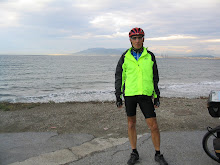
Acadia Park is just a few miles from Bar Harbor, Maine. Our first adventure was to cycle the Park’s carriage roads. These gravel roads were built by John D. Rockefeller, Jr. before the island became a national park. The roads allowed the island’s wealthy residents to ride their horses and buggies over the island to see its wonderful lakes, mountains, and scenic overlooks. Forty miles of carriage roads are still closed to motorized vehicles and widely used by walkers and bicyclists. We cycled a route to see all of the park’s lakes and overlooks and for Joe to photograph all 17 of the carriage roads’ stone arch bridges.
 While we had many climbs, they were not difficult (since they were built for horse drawn carriages). The first couple of descents were cautious with a liberal application of our brakes. However, the down hills became fantastic once we got comfortable with the gravel surface. Words cannot describe the peaceful moments we enjoyed along the lakes or the “wow” moments the vistas offered after a long climb.
Our second cycling excursion was on the Park’s Loop Road. This paved road snakes about 30 miles along the coast, through valleys, and up and down many hills as it loops through the park. Even though the road has 2 lanes, much of it is restricted to one way traffic in a clockwise direction. We stopped at every pull-off and point of interest along the way. At Sand Beach we left our bikes and stuck our toes in the ocean. We figured that this area got its name because most of the Park’s shore line is covered in rocks. Another stop was at Thunder Hole—a narrow rocky cove with caves that “thunder” as high tide rolls in. Since we were there at low tide, we drove back in the evening to hear the thunder. However, the hole did not thunder. We were told that the “thunder” is best during full moon and bad weather—2 things that we didn’t include in our planning.
Cycling, not sightseeing became our focus once we left the ocean side of the Park Loop Road. We enjoyed the gentle climbs and surprising fast downhill rides as we approached Cadillac Mountain. The climb up this mountain was 3.5 miles with sweeping switch backs and only a few steep grades. The climb was well worth the effort. At 1,530 feet above sea level, it is the highest point on the island. The views were fantastic and we could see far out into the ocean and back into the mainland. Needless to say, our ride down the mountain was great. The broad sweeping curves allowed fast descents. In fact, slow moving cars pulled off the road to let us pass as we flew downward. Cadillac Mountain has the distinction of hosting the first sunrise to reach the United States.
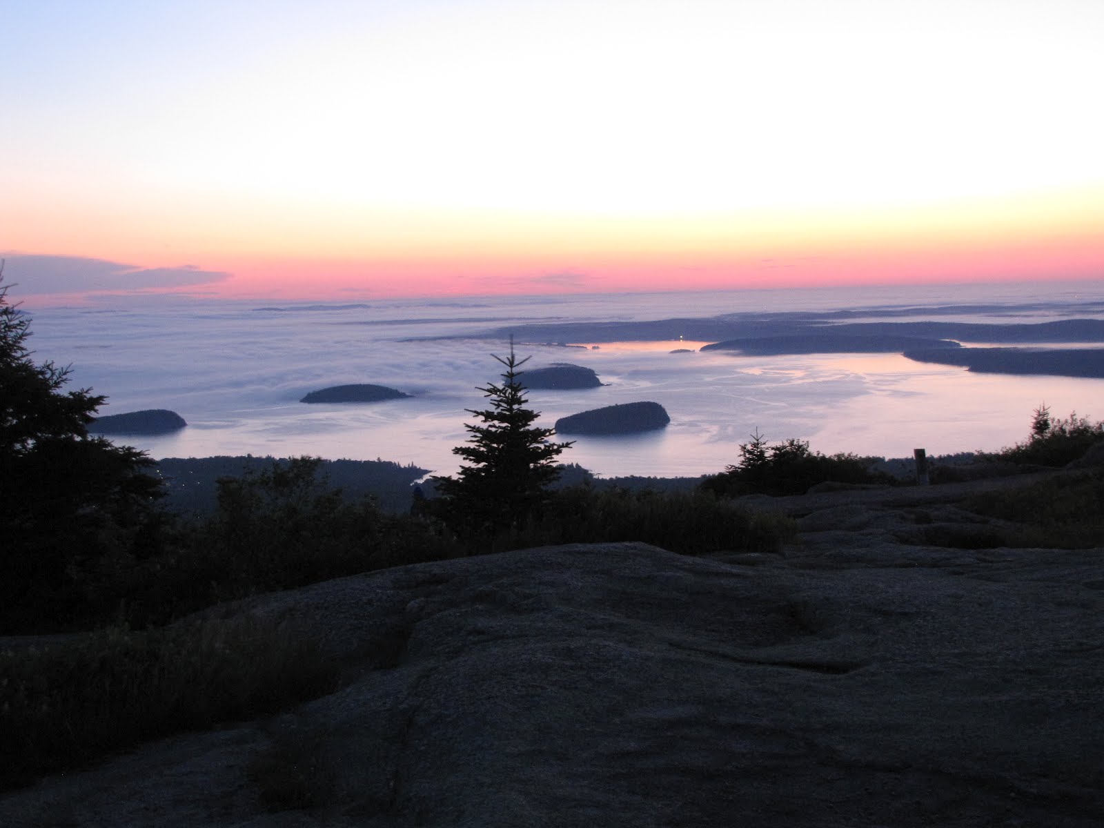 Not wanting to miss a minute of the next day, we were on Cadillac Mountain at 4:30 a.m. waiting for the 5 a.m. sunrise. It was worth the early morning start to see the sun rise over the ocean. However, we were not alone. This popular tourist destination was crowded and one ingenious person set up his camp stove and brewed coffee. After descending the mountain, we decided to cycle the Loop Road for the second time. However, this time our focus was not sightseeing but just cycling. Our speed was up and stops were eliminated. We had a fantastic ride. When we reached Cadillac Mountain, we just had to climb it again.
 In the afternoon, we drove to the nearby town of Southwest Harbor for a sea kayak tour. After being outfitted, we put into the water at Seal Sound and paddled 6.5 miles to the town of Pretty Marsh. During our journey we quickly realized that cycling did not prepare us for kayaking. We were tired after nearly 3 hours on the water but had a great time.
Annapolis Valley
It was difficult to leave Acadia Park’s natural wonders and great cycling. Our drive north took us through small towns and over some narrow highways before we reached Calais, Maine, where we crossed the border into Canada. We stopped for the night in St. John, New Brunswick. The next morning we took a foggy 3 hour (45 mile) ferry ride across Fundy Bay to Nova Scotia, Canada. As we approached the dock in Digby, Nova Scotia, the fog cleared allowing us to see this part of the Acadian coast. From there we could see the coastline and mountains that hid Annapolis Valley, where we planned to spend several days cycling.
 We took 3 rides in the Annapolis Valley leaving from the towns of Annapolis Royal, Middleton, and Wolfville. During each ride we climbed out of the valley to cycle along the Fundy Bay coast. In the evenings we stayed in historic B&Bs and enjoyed Fundy Bay's fresh sea scallops.
Each of our Annapolis Valley rides started with morning fog, cool temperatures, and a climb. While the fog delayed our enjoyment of Fundy Bay, it did turn our focus to all the gardens and wild flowers that bordered the roads. The variety of colors and plant types were wonderful. God must have used all the colors in a box of 48 crayons when planting these flowers. During these rides, we stopped at local restaurants, fruit stands, wineries, and art studios. We also met many interesting French speaking Acadians.
We took 3 rides in the Annapolis Valley leaving from the towns of Annapolis Royal, Middleton, and Wolfville. During each ride we climbed out of the valley to cycle along the Fundy Bay coast. In the evenings we stayed in historic B&Bs and enjoyed Fundy Bay's fresh sea scallops.
Each of our Annapolis Valley rides started with morning fog, cool temperatures, and a climb. While the fog delayed our enjoyment of Fundy Bay, it did turn our focus to all the gardens and wild flowers that bordered the roads. The variety of colors and plant types were wonderful. God must have used all the colors in a box of 48 crayons when planting these flowers. During these rides, we stopped at local restaurants, fruit stands, wineries, and art studios. We also met many interesting French speaking Acadians.In Wolfville, we stayed at the Victoria’s Historic Inn that was built in 1893 by William Henry Chase. Locally, Mr. Chase was known as the “Apple King” because he built the province’s first railway warehouse which became a major shipping point for the region’s apple crop. By 1933 he was one of the world's largest apple exporters.
For obvious reasons, my friend Joe wanted to stop for dinner at a Wolfville restaurant called “Joe’s”. When we sat down, our waitress told us that it was spaghetti night and servings were only $2.88 with the purchase of a drink. Since most of our meals on this trip had been expensive, we thought that we were going to get off cheaply. We each ordered spaghetti and a beer. Only when the bill came, did we realize that our beers cost $7.00 each, more than twice the cost of our meal.
Before leaving Wolfville, we wanted to experience Fundy Bay’s famous tidal bores. Tidal bores are the phenomenon in which the leading edge of the incoming tide forms a wave (or waves) of water that travels up a river or narrow bay against the direction of the current. Some tidal bores have been reported to be as high as several feet, resulting in a high tide that can be 50 above the low tide level. We asked several people where to witness the tidal bores and got as many different answers. Even our internet search produced more options. We chose one that took us north along the Minas Basin and towards Fundy Bay. We cycled gently rolling hills for about 20 miles until we got to our selected spot. However, our timing was lousy and we did not see any surge of water. However, judging by the dock’s ladder the water rose over 2 feet in one-half hour.
Disappointed, we had one more option to see the tidal bores. During our drive to Cape Breton Island we stopped at the town of Turo, a popular tidal bore viewing location. We joined about 50 other tourist and witnessed the river moving in reverse as the tidal bore rushed to our vantage point and raised the water level several feet in about 10 minutes. While the experience was worthwhile, it was not as dramatic as we had hoped to see. At the welcome center we were told that “the fuller the moon the more dramatic the tidal bore.” Unfortunately, we didn’t consider the moon phases in our trip plan.
Cape Breton Island and the Cabot Trail
We drove to the town of Beddeck, Nova Scotia and left our van there for our excursion around Cape Breton Island. The highway that circumnavigates the island is called the Cabot Trail and it goes through Canada’s Cape Breton Highlands National Park. Because of its mountainous terrain, Highlands Park was appropriately named.
 Our first day started out with cool temperatures and a warm-up climb of 500 feet. After the climb, we had forests and fog for many miles. Then, our day changed for the better. In the middle of “nowhere” we smelled fresh baked goods and it wasn’t long until we found the Dancing Goat Bakery and Café. The wonderful smells matched their excellent tasting pastries. As we lingered there we met several employees who were also cyclists. Soon after leaving, the forest and fog disappeared as we dropped into a long valley that was populated with farms. We were rolling along at a good clip when we spotted a bald eagle sitting in a tree just off to our right. It was majestic and posed for many pictures.
At the end of the valley, we came to the Gulf of St. Lawrence. We could not ask for anything more as we turned north and cycled along the ocean. We stopped for the day at a small fishing/tourist town called Cheticamp where we enjoyed a nice motel and restaurant. After dinner, we went to a bar and listened to a local female folk singer. Her music was a mixture of English and Acadian.
 The next morning, we woke up to strong winds blowing off the ocean. We headed north on the Cabot Trail fighting side winds before turning inland where we enjoyed a few miles of tail winds. Shortly after that we entered Cape Breton Highlands National Park and met 3 roadies that were also going to the town of Pleasant Bay. While our ride would be only 28 miles over the mountains, they planned to return the same day. Approaching French and MacKenzie Mountains we enjoyed ocean-side cycling. As we dropped down from the mountain we enjoyed ocean vistas and a view of our destination, Pleasant Bay.
 The next day, our challenge was the climb up North Mountain. While not as long a climb as French Mountain, it was much steeper. We felt pretty smug as we cycled past a sign that indicated that the incline was 13 percent. Shortly thereafter, the grade increased to 18 percent and we had to walk our bikes until it went back to a mere 13 percent. At the top, we met several roadies that were also sucking air after their climb. As we all recovered, we shared cycling stories and they offered some suggestions to enhance our upcoming route. Just when we thought that North Mountain gave us “it’s all”, we started down the other side and were shocked by the steep grades. Thankfully, we cycled up the “easy” side but going down the other side was no cake walk.
 At the bottom, we had to cycle further to get to our night’s lodging. We followed the signs that indicated our motel was just 3 miles off route in the town of Dingwall. Because we were headed away from civilization, we became skeptical that we were on the right road. It was scenic as we cycled out the peninsula toward the ocean. Just as the paved road ended and before the waves hit us, we found the Markland Beach Cottages. Our log cabin sat on top of a sloping mowed lawn that led to the ocean. As soon as we cleaned up, we headed to the beach. By far this was the best location for a nights lodging (and the cottage was also very nice).
The Markland has its own restaurant. For dinner we had salads, fresh halibut served with grilled new potatoes, lightly steamed fresh asparagus, and desert. All pastries were made on site and our waitress was also the baker. She recommended the carrot cake and it was great. Afterwards, we were stuffed and took a walk on the beach before retiring. Falling asleep to the waves breaking on the shore was a good way to crash after the day’s steep climbs. In the morning we had fresh baked pastries, rolls, and biscuits, fresh fruit, hot hard boiled eggs, and coffee. Needless to say, we consumed lots of calories and fats for the start of our ride to the town of Ingonish.
We had the choice of taking the new Cabot Trail with one large climb and then traveling through the forests or the old Cabot Trail with 2 moderate climbs and mostly coastline views (the route recommended by roadies we met on North Mountain). We chose the old trail which needed repaving but had no traffic. We climbed 2 hills that were easy except for the 3 short 18 percent grades that we had to contend with. About 10 miles out of Ingonish we rejoined the main Cabot Trail.

Our last day, was also our longest cycling day, 70 miles. While our cycling was done, we still had a very long drive back to Joe’s home in New York and mine in Virginia. Despite our long drives, it was a wonderful trip and produced great memories and photos that will be enjoyed for a long time.