Photo Credits: Joseph Insalaco and Hans-Peter Tinguely
 We met in 2002, on an
Adventure Cycling bicycle trip across the United States. Joe is from New York State, HP from Switzerland,
and I am from Virginia. Those many years
ago, we had to get up every morning, pack our tents, and cycle. There was a schedule and no debate. Now our cycling adventures are more relaxed:
off route stops are encouraged, short cuts accepted, long lunches at a
micro-brewery are contemplated, and tents left at home. In July 2018, we cycled the Gaspé Peninsula
in Quebec, Canada, where beautiful waters and challenging climbs abound.
We met in 2002, on an
Adventure Cycling bicycle trip across the United States. Joe is from New York State, HP from Switzerland,
and I am from Virginia. Those many years
ago, we had to get up every morning, pack our tents, and cycle. There was a schedule and no debate. Now our cycling adventures are more relaxed:
off route stops are encouraged, short cuts accepted, long lunches at a
micro-brewery are contemplated, and tents left at home. In July 2018, we cycled the Gaspé Peninsula
in Quebec, Canada, where beautiful waters and challenging climbs abound.
The Gaspésie
(official name), or Gaspé Peninsula, is a peninsula along the south shore of
the Saint Lawrence River that extends into the Gulf of Saint Lawrence. The origin of the name "Gaspé" means
"end", referring to the end of the land. Our 11 day journey around
the end of the land was 540 miles and included 36,000 feet of climbing.
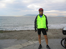
We met in Ste. Flavie,
a tourist town on the Saint Lawrence River.
The town dates to the mid-1800 and has many restaurants, hotels, a beach,
and an artist community. While Joe and I
drove there, HP flew from Switzerland to Montréal, rented an E-bike and then
cycled over 400 miles to Ste. Flavie for the start of our trip.
Our Gaspé cycling
began under overcast skies and light rain.
Not wanting to miss any highlights we made 2 stops within the first few
miles. At the Parc de la Riviere Mitis,
we toured the museum and hiked the trails.
The museum contained some very interesting fossils and native artifacts. We next stopped at the Reford Gardens. The gardens have 3,000 species of native and
exotic plants in 18 areas, as well as many sculptures, both traditional and
modern. According to our guide book, it
is “the most renowned and internationally recognized gardens in North
America.” We agreed that the gardens
were spectacular. In contrast to day’s
overcast sky and light rain, the flower’s vibrant colors popped, enhancing our
enjoyment of the park’s beauty.
Later, the weather
cleared, the sun came out as we continued north east on route 132, the only
route around the peninsula. While we had
GPSs and maps, none were needed. For the
most part, the traffic on route 132 was relatively light. However, every chance
we had we diverted to the “old route 132” that went thru the towns and along
the St. Lawrence.
We met 2 guys cycling
the peninsula in the opposite direction. They claimed the climbs were easier
that way, but the head winds were tough.
One was a high school science teacher the other an oceanographer, both
in their 20s. We enjoyed their stories
of wild camping, subsisting on the fish and crabs that they caught, and their nightly
parting in brewpubs. Their wanderlust
was an interesting contrast to our indoor lodgings, restaurant meals, and early
bed times. At their recommendation, we next stopped in the city of Matane and
had lunch at the La Fabrique micro-brewery.
In the town of
Sainte-Felicite, we stayed at a hostel (Auberge
de Jeunesse du Manoir des Sapins). While
the building was old, it was well maintained and staffed by some of the nicest
people. The down side of the hostel was
that it did not serve dinner or breakfast and no restaurants were nearby. HP went to the only (but not well stocked)
grocery and found fixings for our dinner which he cooked in the hostel’s
kitchen.
The next morning, we
left the hostel without breakfast but found a restaurant about 5 miles away. The early part of our ride had many hills and
each one was a little longer than the last.
While none of them were steep, they were tiring. The middle of that days’ ride was flat but we
encountered head winds which weren’t so bad.
In fact, they helped keep us cool in the warmth of the afternoon. About mile 40, in a 52 mile day, we got off
the highway and cycled thru a “one-street” town that was nearly 5 miles
long. The town had hotels and
restaurants, all calling us to stop.
However, we moved on, encountering several more hills before arriving at
our nights lodging.
 This night’s lodging was
chosen to balance out our daily mileage.
We reached the Auberge Festive Sea Shack by dropping off the highway
down a steep gravel road. The Sea Shack
is a compound of yurts, A-frame cabins, and tent camping on the beach. They
have a circular open-air bar overlooking the beach, and a carryout food-stand
that “cooked-to-order” some interesting meals. Blues/rock music played at a
moderate volume over the compound and the bar had half a dozen micro-brew beers
and ciders on tap. An interesting sign
posted near the bar prohibited smoking "grass" on Sea Shack property
but further stated that “everything was okay on the beach”. Except for us old guys, the average age was
in the mid-twenties. Most males and
females were minimally clothed but full of tattoos and piercings. However, several females were in dresses and
hats that looked like vintage clothing from the 1930s. While it was relatively
quiet, the Sea Shack is known for its wild summer concerts. No concert was scheduled for that night but around
11 p.m. the music style changed and the volume increased to a loud pulsating
cacophony of endless noise (yes we are old) that lasted until 3 a.m.
This night’s lodging was
chosen to balance out our daily mileage.
We reached the Auberge Festive Sea Shack by dropping off the highway
down a steep gravel road. The Sea Shack
is a compound of yurts, A-frame cabins, and tent camping on the beach. They
have a circular open-air bar overlooking the beach, and a carryout food-stand
that “cooked-to-order” some interesting meals. Blues/rock music played at a
moderate volume over the compound and the bar had half a dozen micro-brew beers
and ciders on tap. An interesting sign
posted near the bar prohibited smoking "grass" on Sea Shack property
but further stated that “everything was okay on the beach”. Except for us old guys, the average age was
in the mid-twenties. Most males and
females were minimally clothed but full of tattoos and piercings. However, several females were in dresses and
hats that looked like vintage clothing from the 1930s. While it was relatively
quiet, the Sea Shack is known for its wild summer concerts. No concert was scheduled for that night but around
11 p.m. the music style changed and the volume increased to a loud pulsating
cacophony of endless noise (yes we are old) that lasted until 3 a.m.
We decided on an
early start and were tempted to make noise; however, we behaved and left
quietly. Joe and I pushed our bikes up
the steep gravel road to the highway but HP road his electric bike. He looked like a potentate on a sedan chair
waiving and smiling at the peasants. We
started without breakfast but, after several climbs, we came upon a small café
that was just opening for the day. Antoine,
the owner, roasted beans on-site and served us Brazilian coffee and homemade
muffins. About half way thru the day’s
ride we finally found a restaurant for a full breakfast. While the day started with climbs and
headwinds, the cycling gods smiled on us. The road flattened and we picked up a
powerful tailwind that pushed us at 20 plus mph to our night’s lodging.
The next day was a
tough day, a long day, a constant climb day, and it was hard. We went over the mountains that separate the
Seaway from the Atlantic Ocean. As soon
as we left our motel we started climbing.
It was long and steep. After 2 more miles we had a short downhill before
climbing again. That was typical of the
day. The downhills even had up-hills and
the up-hills had false crests requiring more climbing. The few screaming down hills required
diligence to stay out of the ruts and pot holes in the road. Our typical day had
between 2,000 and 3,000 feet of climbing.
Getting to the Atlantic side required almost 7,000 feet of
climbing. On the brighter side, the
views of the Atlantic were spectacular.
Even with his electric bike HP was tired and Joe and I were
exhausted.
 Our first day on the
Atlantic side was beautiful. We woke to blue skies, pleasant temperature and a
fresh ocean breeze. The day began with a
long climb which took us inland from the coast. At first, our leg muscles
reminded us of yesterday's 6,600 feet of climbs, but soon we warmed up and made
the ascent in good shape. Then a fast
descent took us back to the coast. Mid-morning
we arrived at the bay L'Anse-au-Griffon and the Forillon National Park. This
scenic park juts out into the Gulf of St. Lawrence and is wild and rugged with
scenic limestone cliffs. The park is also the site of a historic lighthouse,
the tallest in Canada and one of many that were along our route.
Our first day on the
Atlantic side was beautiful. We woke to blue skies, pleasant temperature and a
fresh ocean breeze. The day began with a
long climb which took us inland from the coast. At first, our leg muscles
reminded us of yesterday's 6,600 feet of climbs, but soon we warmed up and made
the ascent in good shape. Then a fast
descent took us back to the coast. Mid-morning
we arrived at the bay L'Anse-au-Griffon and the Forillon National Park. This
scenic park juts out into the Gulf of St. Lawrence and is wild and rugged with
scenic limestone cliffs. The park is also the site of a historic lighthouse,
the tallest in Canada and one of many that were along our route.
Rather that cycling
around the park’s perimeter, we chose to cycle thru the park on a trail. The trail had a big climb but we were
sheltered from the sun by the thick forest.
The seclusion and silence was only interrupted by the birdsong that
encouraged us onward.
Exiting the park, we
returned to civilization and got back on route 132. We soon stopped to explore Fort Ramsay. The
Fort was built in 1940 to protect the bay from a German invasion. A few miles
further along the bay, we reached our day’s destination, the town of Gaspé. The town is the peninsula’s administrative and
commercial center. In July 1543, Jacques Cartier landed here and claimed the
land in the name of the King of France.
 The next morning we
left the town on a 6 mile paved trail that took us back to route 132. There we met a jogger who told us that route
132 had some dangerous sections ahead and suggested a short cut. Our ride quickly got very interesting. The
short cut dumped us onto a soft-sand path. We quickly found ourselves up to our knees in
weeds and sand so deep it was hard to push our bikes. Next, we had to cross an abandoned railroad
bridge that required careful steps on the wooden ties. On the other side of the bridge we had more
soft sand before returning to route 132.
We felt like hobos, but taking this 2 mile short cut saved us 9 miles of
questionable highway cycling.
The next morning we
left the town on a 6 mile paved trail that took us back to route 132. There we met a jogger who told us that route
132 had some dangerous sections ahead and suggested a short cut. Our ride quickly got very interesting. The
short cut dumped us onto a soft-sand path. We quickly found ourselves up to our knees in
weeds and sand so deep it was hard to push our bikes. Next, we had to cross an abandoned railroad
bridge that required careful steps on the wooden ties. On the other side of the bridge we had more
soft sand before returning to route 132.
We felt like hobos, but taking this 2 mile short cut saved us 9 miles of
questionable highway cycling.  Our day continued
with rolling (but gentle) hills until we got to another shortcut. This trail
was labeled as the “cycle route” and went thru the Malbaie Salt Marsh. The cycle route was just as challenging as
the last shortcut. In many sections
the asphalt was washed away by the tide and in some places replaced by loose
grave that made it difficult to push our bikes.
We could not believe that this was a designated cycle route. On the other side of the salt marsh route 132
had another big climb. We were told that
this would be very difficult but after the past several days of climbing, we
thought that it was not as bad as described.
At the top of the mountain we stopped at a café that provide a fantastic
view of the bay and Percé Rock below.
After a locally brewed beer (only 1 each) we dropped down into the town
of Percé, enjoying a fast 17% decline. Percé,
was a fishing village that is now a popular tourist stop. The town gets its name from a heavily eroded
rock, which is pierced (percé in French) by a large hole at one end. Indeed,
the whole coast is a magnificent natural spectacle that's incredibly picturesque
with rocky outcrops, towering cliffs, and surf.
Our day continued
with rolling (but gentle) hills until we got to another shortcut. This trail
was labeled as the “cycle route” and went thru the Malbaie Salt Marsh. The cycle route was just as challenging as
the last shortcut. In many sections
the asphalt was washed away by the tide and in some places replaced by loose
grave that made it difficult to push our bikes.
We could not believe that this was a designated cycle route. On the other side of the salt marsh route 132
had another big climb. We were told that
this would be very difficult but after the past several days of climbing, we
thought that it was not as bad as described.
At the top of the mountain we stopped at a café that provide a fantastic
view of the bay and Percé Rock below.
After a locally brewed beer (only 1 each) we dropped down into the town
of Percé, enjoying a fast 17% decline. Percé,
was a fishing village that is now a popular tourist stop. The town gets its name from a heavily eroded
rock, which is pierced (percé in French) by a large hole at one end. Indeed,
the whole coast is a magnificent natural spectacle that's incredibly picturesque
with rocky outcrops, towering cliffs, and surf.
 Our route first took
us northeast along the St. Lawrence River, then out to the Atlantic Ocean. Leaving
Percé we cycled along the south side of the peninsula by the Baie de la Chaleur
(bay). The bay is known for its warm
temperatures where salmon spawn in the gravel banks of its tributaries. In contrast to the earlier part of the
peninsula where the climate and terrain were rugged, here we saw sandy beaches packed
with sunbathers. While we did not stop for a swim, HP likened it
to one of his Mediterranean holidays.
Our route first took
us northeast along the St. Lawrence River, then out to the Atlantic Ocean. Leaving
Percé we cycled along the south side of the peninsula by the Baie de la Chaleur
(bay). The bay is known for its warm
temperatures where salmon spawn in the gravel banks of its tributaries. In contrast to the earlier part of the
peninsula where the climate and terrain were rugged, here we saw sandy beaches packed
with sunbathers. While we did not stop for a swim, HP likened it
to one of his Mediterranean holidays.
We ended our day at
the Gîte A l'Abri du Clocher. This B&B is located next to the Catholic
Church and was once its rectory. It had
been carefully renovated and beautifully decorated by the owners Michèle and
José. They still keep one room available for a possible visit by the bishop, even
though he visits only once every four years.
The next morning our hosts provided us with a great breakfast of fresh
fruit with homemade cream, homemade pastries, fresh crepes, coffee, and
juice. Our breakfast made for a good
start to cycle into a rainy day. However, after an hour, the rain tapered off
and the temperatures rose.
For the day’s last 20
miles, we cycled next to the Matapedia River. Mid-day, we took a break under a gazebo
overlooking the river. There, we sat in
the shade, ate our lunch, and met Chery.
She told us that she was born and raised nearby and that the home where
she lived was in her family for seven generations. Many of the men in her family either worked
for the railroad or were fishing guides on the river.
We continued along
the river to our nights lodging (Auberge de la Riviere Matapedia). The fishing lodge was on the opposite side of
the river, accessed by a long covered bridge.
Upon our arrival, Sophia, our hostess, made us comfortable on the
veranda and brought us ice cold beers. Waiting
for our rooms to be ready, we watched the humming birds feed just above our
heads and listened to the river flowing over the rocks. Later that evening, the host prepared dinner
for us and a family visiting from France.
We had a good night’s
sleep at the fishing lodge and woke to a nice breakfast of “pancakes”. The pancakes that we had been eating were
more like crepes than the pancakes we got in the US. They were very dense, some were small but todays
were plate sized. Joe and I got an early
start but HP delayed his start to socialize with the French family. Our route continued along the Matapedia River
and we stopped to watch the fly fishermen work their rods in a ballet of fluid
motion. The temperature rose during
the morning and the humidity was stifling. However, the last several miles were next to a
lake and picture perfect. The night’s B&B
(Gite Grand-Pere Nicole) sat just across from the lake and a park. Upon our arrival, our hostess and her
daughter made us feel very welcome and the offer of the use of their pool was
quickly accepted.
In the morning, our
gracious host and hostess had a wonderful breakfast for us. By the time we ate and loaded our bikes, the
winds picked up. Of course, it was a headwind. Along the way we saw many cyclists sailing by
in the opposite direction. One of them
crossed the highway to talk to us. John
left Vancouver 58 days earlier when he started his trans-Canadian bike ride. He was proud that he had camped all the way
and not spent one night in a motel. We
attribute this to his age. We, on the other hand were proud that we had spent
every night in a “real” lodging. We
ended our cycling tour in Ste. Flavie, where we began.
Over all, our trip
around Gaspe was 540 miles with 36,000 feet of climbing. It took us 11 days of cycling with no
layovers to make the loop around the peninsula.
Since HP’s journey started in Montreal, he cycled 1,000 miles. Leaving Ste. Flavie, we drove to Montreal to
drop off HP for his flight home, and Joe and I continued our drive south to our
homes.
Day Miles
E-Gain Daily destination
1 50.53 2,126 feet Saint-Felicite
2 54.01 3,736 The
Sea Shack
3 51.71 2,887 Saint-Madeleine
de-la-Riviere-Madeleine
4 51.31 6,604 Riviere-Madeleine
5 28.77 2,692 Gaspe
6 41.71 3,267 Perce
7 70.32 4,151 New
Carlisle
8 58.35 2,908 Nouvelle
9 55.47 2,799 Routhierville
10 37.40 2,115 Val-Brillant
11 36.60 2,511 Ste. Flavie
Totals 536.19 35,796 feet
Our daily bog with maps and more pictures, can be seen at: https://gaspeodyssey2018.blogspot.com/
HP’s photo gallery can be seen at: https://www.youtube.com/watch?v=7gkUwd6vXpg&feature=youtu.be