Friday, November 28, 2008

NORTHERN NECK DELIGHTS

(Published in SPOKES: March 2009)

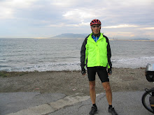
I have long wanted to cycle the Northern Neck region of Virginia but like most good things it just had to wait until the time was right. At the prodding of SPOKES, I finally did it and had a wonderful cycling experience. I cannot remember having as much fun cycling as I did during the 3 days my cycling friend Larry and I spent on the Northern Neck. The October weather was on the cool side but not cold. The traffic was very minimal and the roads were great and mostly flat. However, that is not what made the trip so wonderful. My joy came from being relaxed and not being concerned about mileage. In just 3 days, we stopped at more coffee shops, historic sites, and scenic areas than I did crossing the United States in 90 days; at least that is what it seemed like. I think some of the sites were more powerful than when I first saw the Tetons; not that they were better, far from it, but rather my mind was in a far better place. Cycling the Northern Neck was truly delightful.

The Northern Neck is east of Fredericksburg, Virginia and flanked by the Potomac River on the north, the Rappahannock River on the south and the Chesapeake Bay to the east. According to WIKIPEDIA, the Northern Neck has “1,100 miles of shoreline containing beaches, marinas, old steamship wharfs and small towns that date back to colonial times.” It is about 100 miles from Fredericksburg to the southeastern tip of the Northern Neck, which is just east of the town of White Stone.

While cycling on the Northern Neck offers isolated rural areas, it is not without its great small towns and full services. According the RIVAH VISITOR’S GUIDE the Northern Neck has plenty of places to stay including over 50 motels, bed and breakfasts, and resorts. In addition, it has almost 2 dozen campgrounds and several canoe and kayak rental locations. This guide also reports nearly 200 places to eat and several vineyards to visit and taste. However, we did not find any bike shops. The RIVAH organizes the Neck’s offerings by its 4 counties: Westmoreland, Richmond, Lancaster, and Northumberland. Since I grew up in a Northumberland county in Pennsylvania, this Virginia County has a special place in my heart.

It took us about 2 hours to drive from Northern Virginia to start our first ride on the Northern Neck.

Three rides for 3 days

It was difficult to plan rides that would let us experience the Northern Neck in just 3 days. Therefore, we focused on cycling near its water boundaries. Our first trip started on the Potomac River at Westmoreland State Park. (While we used motels on this trip, we saw that the park has tent camping and cabins.) Before mounting our cycles, we stood on the rivers edge watching the wind create havoc on the water. Even though the cool and windy weather by the water was challenging, we stayed long enough to see either ospreys or eagles (sorry that I don’t know which) circling their nests and looking for food. Leaving the park, we began a 30 mile loop that took us through the countryside past Stafford Hall Plantation, the birthplace of Robert E. Lee, and into the town of Montross where we made our first café stop. In The Art of Coffee café we were greeted by the owner and her friendly staff. We had excellent coffee and sandwiches while enjoying the café’s art gallery. The owner displays and sells her paintings as well as the paintings and crafts created by other Northern Neck artists. From there we continued southwest through mostly agriculture areas toward the Rappahannock River. Finally, we completed our loop by heading northeast back to the Park. The only traffic that we encountered on this trip was on this last section where we cycled several miles on Route 3. However, the traffic was still minimal and drivers courteous.

After loading our bikes, we drove east for our next day’s ride that would take us along the Rappahannock River out to the Chesapeake Bay before heading inland. The second day’s ride started in Irvington on the south eastern part of the Neck. According to the town’s webpage, Irvington dates from 1891 and was part of the steamboat route between Norfolk and Baltimore. The town displays part of a steam boat at its Steamboat Era Museum and offers B&B and resort accommodations, farmers markets, and charter boating.

From Irvington it was only a short ride east to the town of White Stone where we found another great café that roasted its own beans. From there it was only 7 miles east to the Chesapeake Bay. Since this road only leads to the Bay through a low density residential area, we had minimal traffic. After doubling back to White Stone, our route took us north to the town of Kilmarnock. According to the town’s webpage, Kilmarnock was settled in the mid-1600s. To get a flavor for the town, we stopped at The Talk of The Town Coffee House were we met more friendly people. One of those we met was a former bike racer out of Richmond who wished that he had the time and conditioning to join us. Little did he, or we, know that our day would require only minimal conditioning.

Our route through Kilmarnock was to loop us northeast before coming back into town for a loop to the southwest giving us a 60 mile day. This is where relying totally on a GPS can get you into trouble. I recently purchased a GPS for my cycling adventures. This trip was my first real test in using it. I liked not having to read a map and just follow along the route shown on the screen. However, the GPS got confused in Kilmarnock with my planned route. I wanted to do a figure eight that went through the town twice. After our stop, I could not get the GPS to show me the northeast loop. It kept showing me the southwest route that I planned for the second loop through Kilmarnock. So we just gave up and went with the flow and headed southwest. Initially, I thought that the loss of 20 miles would be disappointing. However, as the day turned out the GPS was smarter than me.

We followed our destiny and cycled southwest in a wide circular loop back toward Irvington. On the way, we stopped at the historic Christ Church and received a tour and warm hospitality from its docents. After our “long” ride we wanted to have some refreshments as we neared the town of Irvington. First, we found a winery but it was closed for the day. While disappointed we cycled on and found a café called The Local. It was opened and we rationalized that coffee was probably better for cyclist than wine. One of The Local’s claims to fame is its ice cream. Larry raved over the ice cream’s rich flavor and texture and went into a 2 scoop mode. To burn off all our extra calories we cycled around Irvington for one more look at the Rappahannock Rive before packing up our bikes.

Our third ride started in Warsaw and would take us past another section of the Rappahannock River. Since we had to check out of the motel by 11 a.m., we started our ride early so we would have time to get back for showers before heading home. This meant a very cool start with the October temperatures in the 40 degree range. While Larry was prepared with the correct clothing, I did not have leg or finger coverings and I was cold for the first hour. After that Larry was overdressed and I was comfortable. This 20 mile ride took us northwest before heading southeast toward the river. Along the way we ran into road construction where a new bridge was near completion. Rather than making us take the detour, the workmen allowed us to cycle through, thus keeping us on our route. This route gave us our first and only “hill.” While not much of a climb, it was followed by a long downhill. What surprised me was that we were at water level before and after the hill so it was hard to explain why the downhill seemed much longer than the climb. I guess it was all part of the fantastic journey.

As we got closer to the river, we again saw lots of water birds and deer. We stopped at Naylors Beach Campground located on the bank of the Rappahannock River. While the campground was deserted at this time of the year, it looked like a great place to stay. With the many campgrounds we saw I could easily envision taking a loaded tour through the Northern Neck.

Stopping traffic with a Trike

While I cycled with a standard touring bike (my “yellow bike”), Larry used a Catrike—a very low bike with two 20-inch wheels in the front and one 20-inch wheel in the rear. Every day we were stopped and asked about Larry’s trike. We must have been stopped a dozen times but it became part of our relaxed journey. We forgot the miles and just talked. One man passed Larry and motioned for him to pull over. Larry figured that he was going to catch hell for cycling on the road with what some consider a “toy.” However, the man told Larry that last week he tried a similar trike in Vienna, Virginia. As it turned out, it was the same place that Larry purchased his trike (http://www.bikesatvienna.com/). On the second day in Irvington, the Tides Inn Resort’s lawn crew came to a halt as we cycled by. There we spent about 45 minutes discussing the pros and cons of such a bike. On our last day, a huge orange state highway truck stopped in the middle of the road, the driver turned off its motor and the crew started the all too familiar questions about Larry’s trike.

Lots of history

If historical sites interest you, your bicycle is an excellent way to explore the Northern Neck. According to the RIVAH, there are over 70 museums and historic sites on the Neck. Settlements on the Northern Neck date back to the 1600s. One of the oldest and very interesting structures is Christ Church, located just north of Irvington. The original wood structure was built in 1670 and in 1735 it was replaced by the current brick structure. The church has been restored and is still used, but it was never heated or air conditioned. The church still has its original high-backed box pews that view a towering triple deck pulpit. Sitting in one of box pews I could almost experience an early American preacher standing high up in the pulpit’s third level and raining “fire and brimstone” down upon me because I sometimes cycle on Sundays.

A jump in time and distance will take you to the birthplace of George Washington on route 3 in Westmoreland County. Today, George’s mother, Mary Ball has her own museum in nearby Lancaster County. In Colonial Beach, a short distance away from George’s birthplace you can find the birthplace of James Monroe, our fifth president. Further east along route 3 you can visit the birthplace of Robert E. Lee at Stratford Hall Plantation. This plantation built in the 1700s has been restored and is open to the public.

If presidents and historic churches are not your thing, you can cycle by Hayden Hall in Irvington. Scandalous as it seems today, Sarah Wilder the mistress of Hayden Hall was married at the age of 12. She must have grown up quickly because she and her husband, Tom Hayden, had 11 children in this home which dates from the 1800s. While the RIVAH reports that Sarah’s ghost haunts the home to this day, you will not have an opportunity to meet her for Hayden Hall is a private residence.

Going further south

Before heading home we had the opportunity to cross over the Rappahannock River at White Stone and drive up to Tappahannock, Virginia about 45 miles away. The area south of the Rappahannock, north of the York River, and west of the Chesapeake Bay is called the Middle Peninsula of Virginia. I had not been to this part of Virginia either and it looks like another great place to explore on my yellow bike.

Sunday, June 1, 2008

Cycling Close to Home: Exploring Virginia's Horse Country


Published in SPOKES: June 2008


After cycling across the United States, circumnavigating Switzerland, and exploring Spain, I often wonder “where to” for my next cycling journey. Spokes’ editor suggested that I explore Virginia, my home state. What a novel idea! I have cycled the trails and roads in Northern Virginia and crossed the length of the southern part of the state—a long and hilly ride—when I cycled across the United States. Usually, I have been going “somewhere else” on my cycling trips. In the spring I took my first “cycling closer to home” trip into Virginia’s horse country.

Overview
Since I planed a local trip I decided to actually start cycling from home (no cars, trains, or planes on this trip) by taking the Washington & Old Dominion Rail Trail (W&OD) west out of the metropolitan area to Purcellville before hitting the roads. From there I planed to head south to Middleburg, The Plains, Marshall, and on to Warrenton. After that I would head northwest to Front Royal then head northeast to Paris (Virginia not France), Bluemont, and then back to Purcellville before hopping on the W&OD for the final leg home. I planned to cycle about 200 miles over 4 days.

My local cycling friend Larry and his cycling friend Dave from York, Pennsylvania decided to join me. Larry wanted to try his new recumbent on a tour and Dave wanted a shake-down ride in preparation for his upcoming ride from Astoria, Oregon to his home in PA.

I used Google Maps to find a route that consisted of mostly country roads with low traffic volume. I knew that the terrain would be hilly so I did not even look at that feature of the program. I left home with a print-out of the narrative directions but wished that I had also printed the larger sections of the detailed maps. The level of detail on Google was greater than the state road map that I carried. It would have been helpful to connect the narrative with a map to avoid some of the confusion we had at several unmarked country roads.

Google is also helpful in finding lodgings, restaurants, and bike shops. If you want a Bed and Breakfast you will have no trouble finding lots of accommodations along this route. However, motels are only found in Leesburg, Warrenton, and Front Royal. By using B&Bs you will have greater flexibility in controlling the length of your riding days. Restaurants, cafés, and other food stops are found in all the towns that we cycled through.

Heading West on the W&OD

Our trip started in less than ideal conditions. The weekend weather prior to start of our trip was a torrential downpour. Despite the continuing rain, we started our journey on a very wet Monday. However, we anticipated better weather for the rest of the week as we left Falls Church (mile 7 on the W&OD trail) and headed west. Surprisingly, we encountered other foul-weather cyclists, joggers, walkers, etc. on the trail. With all the rain a section of the trail near Leesburg was flooded and closed; necessitating a detour onto the roads. Otherwise the trail was in good condition and riding to the end in Purcellville was easy. The W&OD railroad first ran to Purcellville in 1871 but terminated operations in 1968 and later becoming a rail tail.

On the Roads

Purcellville has several restaurants in this part of town. Just make a left off the W&OD onto N. 21 St. and go to Main St. While we were having coffee in Purcellville, one local resident told us that they see lots of cyclists on route VA-690 heading towards Middleburg and that most drivers took their time passing the bicyclists. We had no trouble with the cars and made several stops to look at the wildflowers and horses. We were still on the fringe of “horse country” but my untrained eye saw lots of good looking horses.

Falls Church to Middleburg: 55 miles
W&OD Trail to Purcellville
Left onto N. 21 St.
Left at Main St. (Route 7)
Immediate right at Nursery Ave (VA-690)
Left at S 32nd St. (continuing on VA-690)
Cross Snickersville Turnpike and VA-690 becomes VA-611
Left on Foxcroft Rd to Middlesburg.

We arrived in Middleburg in time for lunch. Middleburg was established in the late 1700s and supposedly got its name because it was midway between Alexandria and Winchester. This little town has several good meal options ranging from a grocery store bag lunch to fine dining. We chose a café called Mello Out on E. Federal St. and had interesting sandwiches and drinks while we relaxed and listened to several local horse owners talk about the trials and tribulations of owning a horse. Based on what they said, we were thankful that we only had bicycles to contend with. You may want to plan your cycling trip to Middleburg to take advantage of its horses, fox hunting, and steeplechases. Or plan your trip for May when the town hosts the “Hunt Country Stable Tour.” I took this tour several years ago and was amazed at how well the horses lived. In fact, one stable even had a swimming pool for its horses.

Middleburg to Warrenton: 30 miles
Right on US-50
Left on VA-626 to The Plains
Right on VA-55 to Marshall
Left on US-17
Right at Carters Run Rd.
Left at Wilson Rd
Left at Cannonball Gate Rd.
Continue on Bear Wallow Rd
Right at Norfolk Dr.
Left at Gold Cup Dr. into business district


Next, we headed south to The Plains. The W&OD was flat but the further south we got the more rolling hills we cycled. None of them were difficult and the change of pace was nice. We were now in the heart of Virginia’s horse country which made stopping by the side of the road very enjoyable. We also noticed that the number of wineries was increasing as we headed south. It would be fun to plan a cycling trip that incorporated stops at several of them. In hindsight I wondered why I chose to tour the horse country and not the wine country.

The Plains is a very small town but you won’t go hungry as the town has several cafés where cyclists are welcome. In The Plains we met a man interested in our ride. While in his professional life he is a mine inspector, his and his wife’s passion is competing in long distance cycling races. We were definitely not racing since we only averaged 12 mph. However, as with most cyclists we found a common bond as we swapped cycling stories.

From the Plains we headed about 5 miles west to Marshall. In case you are wondering, Marshall got its name from our first Chief Justice, John Marshall. If you did not want to do a horse or wine tour of this area, you could do a history tour. Many of these towns were founded in the 1700’s and later saw action during the Civil War.

Our First Climb

Leaving route VA-55 we headed south for a short distance on Winchester Road (US-17). While this highway has more traffic it also had a shoulder. Just after crossing over Route 66 we made a right turn onto Carters Run Rd and quickly into the calm of another good country road. This was great cycling until we neared Warrenton and had to climb Viewtree Mountain. While the climb was only several hundred feet in elevation, it was steep. I rationalized that a short walk would do my legs good and ended up pushing my bike up the steepest part. Since Dave and Larry were also walking, they must have wanted to stretch their legs as well.

One of Warrenton’s “claims to fame” is that it hosted Virginia’s first Gold Cup Race in 1922. Like most towns we visited, Warrenton has maintained its historic district with many early American buildings still intact. That is amazing considering that during the Civil War the town “changed hands 67 times.”

Warrenton to Leesburg: 75 miles
Left from Gold Cup Dr. at Blue Ridge St.
Right at Waterloo Rd
Continue on Old Waterloo Rd
Left at Old Waterloo Rd
Right on Leeds Manor Rd
In Hume, left on Hume Rd
Right on Fiery Run Rd
Stay on Fiery Run Rd (several miles of unpaved surface)
Right at VA-55
Left at VA -688
Left at US-17
Left on US-50
Right on VA-601 Blueridge Mountain Rd
Right on VA-7 at Snickers Gap to Purcellville
Left on 21 St
Right on W&OD to Leesburg

Getting Lost is Part of the Adventure

We left Warrenton early in the morning and experienced some traffic getting out of town. But within a few miles the traffic disappeared and we were again cycling on country roads. Before we got to Hume we found a café and stopped for a break. After we got on the road again we were thankful for the stop because we did not find another place until we reached VA-55. While we had originally planned to go into Front Royal we got confused when we reached Fiery Run Road. Where was the detailed Google map when I need it? We should have gone straight because Hume Road became Fiery Run Road going west but we chose to go right on Fiery Run Road heading north. If we had gone straight on Hume Rd it would have taken us to US-522. From there we would have made a right and headed north into Front Royal. However, our right turn on Fiery Run Road took us directly to VA-55 but over several miles of unpaved road. Yes, that became just another part of the “adventure.”

Front Royal is the gateway to the Shenandoah’s with access to Skyline Drive, Shenandoah National Park, and the Shenandoah River. However, I later learned from the town’s web page that by missing Front Royal I missed a great piece of baseball trivia. The Front Royal Cardinals play in the Bing Crosby Stadium; named for the singer because of his donations of land and money.

After turning onto VA-55, we passed a crossing for the Appalachian Hiking Trail that would run parallel to our ride north on VA-688 and VA-601. Dave recently hiked the entire trail and Larry has hiked a good portion of it.

Always Another Climb

After leaving VA-55 we encountered our first big climb of the day. We headed north on VA-688 toward Paris and had a 600 foot climb over the mountain. We reached this point in our trip after cycling 35 miles over rolling hills and on dirt roads. However, it was very scenic with farms and more horses along the way. We also passed the 4,000 acre Thompson State Wildlife Management Area (which hosts 7 miles of the Appalachian Trail) and the Green’s Mill site (the mill was built between 1818 and 1823). What bothered us was that we knew that we had another climb facing us as we cycled up Blueridge Mountain Road.

The Blueridge Mountain Road climb seemed steeper and the 3 of us ended up walking our bikes up the worst part as we swatted away the mosquitoes and gnats. Once we got back on our bikes we cycled for several miles along the top of the ridge before heading down to route VA-7. We had been paralleling the Appalachian Trail during most of this climb and hoped to stop at the nearby hostel. However the hostel was about half way down the mountain and we chose not to interrupt our great down-hill ride. Once we hit VA-7, we literally had a long down hill ride all the way to Leesburg--about 20 blessed miles!

We reached Leesburg after cycling 75 miles on loaded bikes and climbing 2 big hills. Surprisingly, we all felt that we could continue the rest of the way home. However, we had reservations to stay in Leesburg and decided to keep to our original plan. While all the towns we visited were very nice, Leesburg has always been one of my favorite towns. I like the feel of the town, its historic district, great restaurants, and bike shops. The town also has horses, wineries, and was the home of George Marshall of WWII fame.

The next morning was just a short-flat ride of 26 miles on the W&OD trail. Within a few hours I arrived home in Falls Church.

Monday, February 25, 2008

Canadian Rockies

The Great Parks North Cycling Tour:
Jasper Park in Alberta, Canada to
Glacier Park in Whitefish, MT


Did you ever wonder what it would be like to spend time in one of those fantastic picture postcards? You know the postcards that show snow-covered mountains, fast-running rivers, and wild animals. My cycling trip through the Canadian Rocky Mountains provided such an experience. However, as you read my narrative and view the photographs you may not fully appreciate the beauty and majesty of being integrated into this environment, unless you too have been there.

My trip started like many others. It took me all day to get ready. I was not sure of how best to pack my gear for the train trip and what I would do with my luggage when I was cycling. Larry picked me up at 3 p.m. and drove me and my bike to Union Station in Washington, DC to catch Amtrak train #29 leaving at 5:20 p.m. for Chicago. Larry had planned to go on this trip but had to cancel because he had not yet fully recovered from pneumonia.

After much anticipation and some anxiety I spent my first night sleeping on the train. Before this my train trips were just hours long. However, this trip involved sleeping 2 nights on the train. I decided to sleep in the coach rather than in a sleeping car because it was significantly cheaper and I figured that it would prepare me for the upcoming nights that I would spend in my tent. In Chicago I met my friends from NY—Joe, Jack, Dick, and Ray—where we boarded another train for the second leg of the trip to Whitefish, MT. These four guys and Hans-Peter, who we would meet in Whitefish, were on my cross-country trip in 2002. We arrived in Whitefish on time (9 p.m.). Despite the late hour and long trip we all had plenty of energy to move our bikes, boxes, and bodies to the Downtowner Motel. After being on the train for 3 days and 2 nights I relished the idea of a hot shower and a real bed.

The town of Whitefish is a great tourist town for those who love the outdoors. It is located near Big Mountain (a sky resort) and Whitefish Lake. While the town was originally nicknamed “Stumptown” because of its logging heritage, this name does not reflect its exciting character and many interesting shops, restaurants, and activities. Whitefish has a population of 9,500 and is at 3,040 feet of altitude.

Our first morning in Whitefish started with a great breakfast at the Buffalo Café with its nontraditional menu and large portions. Later we went to the Glacier Cyclery (a wonderful and very helpful bike shop) to drop off our bike boxes and extra gear and purchase last minute things that were forgotten. We had lunch at Truby’s outdoor café before we cycled up Big Mountain. On the way up a black bear crossed in front of us. However, it disappeared into the woods too quickly to get out our cameras. After cycling an hour we reached the lodge area and we took the chair lift to the top of the mountain (which took about 40 minutes). We sat for a while in the cold air and listened to 2 folk musicians entertain café patrons and watched mountain bikers hop off the chair lift, hope on their bikes, and disappear down the steep and twisting trails. On the top of Big Mountain we got a picture postcard view of the entire area. It was about 20 degrees cooler at the top and the wind-chill made us even colder. On the way back down, I took another picture postcard shot with my camera.

Later in the day we left the comfort of the motel to join the rest of our tour group at the KOA campground that was 5 miles west of town. Despite leaving the comfort of the motel, it was great to be outdoors and sleeping in my tent. The next day the rest of our Adventure Cycling group arrived, set up their tents, and got aquainted. Since our first meeting wasn’t planned until dinner time, I decided to cycle around Whitefish Lake. It was a peaceful journey and provided more great photo opportunities. In the evening we had a formal get acquainted meeting at the KOA lodge. Dinner of pizza and beer was enjoyed by all as we discussed the morning’s bus tip to Jasper in Alberta, Canada where our cycling journey was to begin. During the bus ride we stopped to photograph the mountain goats grazing along the road.

The town of Jasper is at the northern end of Jasper National Park. Established in 1907, Jasper National Park is the largest national park in the Canadian Rockies with 10,878 square kilometers of mountain wilderness. We camped in the park and cycled into town to purchase the food for the next 3 days. We were leaving civilization for wilderness camping where no food was available (or showers, or flush toilets, etc). On the way out of Jasper the next morning I photographed an elk grazing near our camp.

For the first 20 miles, our route took us along the Athabasca River toward the Athabasca Falls. The falls were not large but an impressive amount of water moved over them and it provided another postcard moment.

By day’s end I cycled 47 miles to the Jones Creek campground and the journey there provided more picturesque views. The campground was rustic. It had no showers and only pit toilets. Like most of the campsites on this trip we had to put food items into metal bear boxes and make sure that no food or even tooth paste went into our tents.

The next morning started off with cold temperatures (in the 40-degree range) as we left the campground and cycled on The Icefields Parkway. We had some serious climbs and along two scenic rivers—the Sunwapta and Saskatchewan. We stopped at the Athabasac Glacier for a tour. The Glacier is part of the Columbia Icefield and located in Jasper National Park. To get to the glacier we boarded special vehicles that looked like RVs with monster truck tires. These vehicles took us onto the glacier where we got out and walked around. Most of us were bundled up with extra clothing but it was still cold.

Continuing on the Icefield Parkway we cycled up Sunwapta Pass at 6,676 feet. The mountain was full of wild flowers including many “Indian Paint Brush” plants in different colors. At the bottom of the overlook was a very blue colored lake.

So far most of our cycling has been in what is called “a sub-Alpine area” – the areas just below the no-tree zone. The trees in this zone were small for their age. That night we camped at Rampart Creek—another rustic campground. My soapless bath in the glacier-fed creek was very cold and quick. While we only cycled 41-miles it was a long and tiring day.

Finally, we headed back to “civilization” with a 57-mile journey to Lake Louise. Lake Louise is a resort town with a large and civilized campground. Food was available in the village not far from the campground. However, the lake and resort area were a steep 2.5-mile climb up the mountain. The lake sits at the foot of a glacier and was well worth the effort to get there. Unfortunately, none of my pictures captured this wonderful scene.

We left Alberta and entered British Columbia on a short cycling day to the Marble Falls campground—our last rustic place. On the way to Castle Junction I stopped to watch a large male elk grazing just off the road. I was amazed at both the size of this animal and his indifference to the tourists watching him eat. While the day’s ride was only 28 miles we did have a climb that took some time as we cycled over Vermilion Pass (5,145 feet) to our campground.

During our evening meal a sociable small black bear came up to where we were eating. While I ran for my camera, others decided to make noise to scare it away—so no up-close photos of cute baby bears. However, that incident did provide much levity later on. During the night one of our cyclists woke up coughing but the fellow in the next tent thought the noise was a bear. He screamed and tried to get out of his tent. In his panicked state it took him awhile to emerge from the tent and by the time he got out the rest of us were standing around looking for the “bear.” When the fellow with the cough started hacking again the panicked fellow realized that he had not heard a bear and when he admitted it, the group had a good laugh—for many days afterwards.

Next morning we started off with a nice down hill ride but we had a hard climb over Sinclair Pass at 4,875 feet. The climb was long but the downhill to Radium Hot Springs was great—once it got started. The pass had a false top and required climbing for several additional miles after we thought we crossed the pass. Except for the mosquitoes, the Radium Hot Springs campground was nice. It was called Canyon RV Park and was literally in a small wet canyon (with an 8% grade below the highway) that served as a mosquito breeding ground. Most of our meals were eaten in the campground and we took turns cooking and cleaning up. This night’s meal was created by our tour leader. He made a Thai dish consisting of rice, spinach, peanut butter, pineapple, Tabasco sauce, onions, and green peppers. It was a big hit but as soon as we were done eating the mosquitoes attacked in full force. The cleanup crew put on extra clothing and the rest of us headed for our tents.

Thankful that the mosquitoes sent us to bed early, we got up the next morning facing a hard cycling day of 70 miles. We passed through Columbia National Wildlife Area and the town of Invermere. Invermere (with a population of nearly 3,000) was hosting a lively farmers market and craft fair in its historic district. Once we left the town the ride got less enjoyable as the weather got warm and the road conditions deteriorated. We cycled around Windermere Lake but did not get to see much of it. We posed for a group picture at Hoodoos’ Mountain but no one wanted to move so that the mountain would be in the background. Later several of us stopped for lunch at the Fresh Garden Café in a very small town called Canal Flats. Ironically, while the food was good, there were no fresh garden items on the menu. Even the strong riders complained about the day’s ride. That night the group camped at Wasa Lake but I checked into a motel next to the campground. I rationalized that a bed and hot shower were required to rejuvenate my tired body.

I knew I made a good decision the next morning when the group complained that a noisy party in the campground kept them up most of the night. We had another 70-mile day and I was ready. Joe and I left early and missed a turn at Fort Steele, taking us on the main highway. Our ride was nice because of low traffic and a tail wind. We stopped in Jaffray at a country club for breakfast and then decided to stay off route as we headed toward Elko. Because it was later in the morning our route had more traffic but it was not bad. It got hot by the time we reached Elko where we stopped for several milk shakes (each!) before starting on the last leg to Fernie. Our map indicated that we would have rolling hills the rest of the way. However, the map was wrong. After an initial climb out of Elko we had easy cycling and nice scenery. I even stopped to cool off in the Elk River. In Fernie we stayed at the Raging Elk Hostel.


Fernie was our first and only layover day. It was a good-sized town with a population of 4,600. However, no one was in town. We were there during a Canadian national holiday similar to our Labor Day with most shops being closed. The 14 people in town belonged to our group. We spent most of our free time eating and resting.

Leaving Fernie we head for Blairmore and the Lost Lemon Campground. It was a 46-mile day over Crowsnest Pass at 4,457 feet. At the beginning of the day we continued to cycle along the Elk River as we head to Sparwood. At Sparwood we stopped for photo ops at the “world’s largest truck.” Leaving Sprawood we start to climb into the coal mining area as we head for Crowsnest Pass which is also the boarder between British Columbia and Alberta. After crossing the pass we enjoyed 15 miles of down hill cycling. It rained in the evening, the first rain of the trip. Despite the rain the cooks put together a good evening meal.

The day started out with a continuation of the previous day’s down hill until we got to Lee’s Lake Road where the terrain became hilly—not steep hills but constant ups and downs. As we got closer to the town of Pincher Creek we were blessed with a nice tail wind and passed fields of wind driven electrical generators. However, leaving Pincher Creek the terrain again was rolling hills combined with moderate cross winds. We were in the Canadian Plains but heading back into the Rocky Mountains. Overall, it was a tough 66 miles to Waterton Lake National Park—our campground for the evening. Near the park entrance we saw two black bears just off the road and in the town we encountered a very tame deer walking the streets…so much for “wildlife.”

Before leaving Waterton Lake that morning the group had a fancy breakfast at the Prince Edward Hotel that overlooked the lake. It was good that we had a great breakfast because we had a long climb out of the park. Later, we went through the Canadian-U.S. border and up Chief Mountain International Highway. Coming down the other side was a fast and fun ride. At the interchange with route 89 we met up with two more fellows from our 2002 cross-country trip (they drove up from Missoula, MT to join us for several days). We cycled 48 miles to Saint Mary where we stayed at the Johnson RV Park.

Leaving Saint Mary we faced our last, but best climb of the trip. We cycled from East Glacier up the Road-to-the-Sun Highway that runs through Glacier National Park. It was a long but beautiful climb to the top. However, it was not a difficult climb and had lots of great places to stop and smell the roses—waterfalls, overlooks and switchbacks. At the top, the group gathered at the Logan Pass Visitor’s Center for pictures and to kill time before we descended into West Glacier (because of traffic concerns, the road is closed to cyclists until the afternoon). Of course we had another fantastic downhill ride! At the bottom of the hill Joe and I stopped at a lodge and posed with an “old prospector” for a comic postcard. Our 52 mile day took us to a KOA campground just west of the park.

The final ride of the trip was taken in the rain. Some of us missed the “low traffic” route and decided to get to Whitefish the quickest way. While there was a little more traffic we were early enough not to have any problems. We flew over the 27-mile route and got to the motel in about 2 hours. While I was wet and dirty I felt great. After checking into the motel and taking a long hot shower I met the rest of the group at Truby’s for a final lunch.

Our train home was 2 hours late getting to Whitefish. A train derailment earlier had slowed eastbound traffic. Thus we were very late getting to Chicago and I missed my train to DC. However, the guys going to NY were able to get on their train that was also late getting to Chicago. Amtrak put me on a train that went through Philadelphia, PA that was scheduled to arrive in Washington, DC at 8 p.m. the next day. However, it was not all bad news. Riding in the same train car was a Blues band returning from a festival in Spokane, WA and they willingly entertained us.


The delays continued and I did not get to Washington, DC until 2 a.m. on the following day--14 hours after my originally scheduled time. At that hour of the morning the train station was deserted and the Metro and taxies were not running. However, my son was there and he took me home.

Tuesday, February 19, 2008

Grand Canyon-Zion-Brice National Parks


Grand Canyon-Zion-Bryce National Parks
2005 Cycling Trip

Travel log


September 16: The journey began with an early morning flight from Dulles Airport to Las Vegas, NV. While in Las Vegas Larry (a friend from Northern Virginia) and I did the usual tourist things. As “big spenders” we each risked one dollar on the slot machines. I played the quarter machine and Larry played the penny machine. I was board with the slot machine and quit after losing my dollar. Larry could figure out all the buttons and leavers on the penny machine but once he realized that he was $1.92 ahead he quit playing. After that we walked down the strip checking out the eclectic architecture, tourist, and the other people on the streets.

September 17: Cycle America (our tour provider) met us at the hotel where we loaded our gear and bikes for the trip to the north rim of the Grand Canyon. We stopped at St. George, UT where we met the rest of our group and transferred from vans to a bus for the remaining portion of the trip. Cycle America made all the arrangements, provided lodging and meals, and carried our gear each day.

When we got off the bus we were literally on the north rim of the Grand Canyon. The canyon rim lay just a few feet from where I pitched my tent. What an awesome view and what an awesome place to camp! I never imagined the canyon as I saw it. Photographs and TV images don’t capture the canyon’s grandeur.

That night we had dinner in the Lodge and our table overlooked the canyon. My dinner companions were Larry, John (a hard core cyclists from Florida), and Kelly (an ultra-marathoner from North Carolina). After dinner John led us back to camp taking the rim trail. Despite the dark it was a scenic 1.2-mile walk just feet from the canyon’s edge.

During the night the winds roared like a freight train but my tent was calm. I was hearing the draft coming out of the canyon—it was hot in the canyon and cool on top—not surface winds.

September 18: Today started with an early morning walk (temperatures were in the 40-degree range) to see the sun rise over the canyon. Actually, it is not so much to see the sunrise; rather it was to see the sun lighting up the canyon. As the sun gets higher the light goes deeper into the canyon. After breakfast at the lodge I assembled my bike and took it for a test ride to Point Imperial. I was told that this location was the best place in the park to see the California condor—but none made an appearance for us. However, this location did provide excellent vistas. Our 22-mile round trip ride involved several climbs but the view of the eastern canyon was worth the effort. At the top Larry and I met Tracy (from Minnesota) and Lily (from Holland but living in Switzerland) and a couple riding a tandem with a place for their dog.

September 19: The serious cycling begins as we head 80 miles to Kanab, UT (on our way to Zion National Park). It was a cold start with temperatures again in the 40-degree range. However the day quickly warmed up and I stripped along the way. We climbed 2,500 feet out of the Park and got unto a flat open prairie that went for miles. We climbed to over 8,800 feet before we stopped for lunch at Jacob Lake (43 miles into our ride). At mile 55 we reached the scenic view of the Vermilion Cliffs National Monument Wilderness and then we descended into the desert—a 6 percent grade and drop of 5,000 feet. My average speed for the day was 15.4 miles per hour.

Part of my speed must be attributed to the terrain but some resulted from my trying to catch Larry. At one point I stopped to strip off some extra clothes which took me less than a minute. When I started up again I could not see Larry. I cycled faster and faster but could not get a glimpse of him. Unknown to me Larry pulled off just after I did but I did not see him. He spent the hour trying to catch me as I was racing to catch him. We both had a good laugh when we met at the lunch stop.

That night we camped at a commercial campground. Our dinner was provided by the Lariats—a high school dance team—as a fundraiser. They made us a Mexican meal and served it in a school cafeteria. Afterwards the Lariats performed several routines that they were planning to use in national competition.

September 20: Our day started with breakfast at Houston’s Trails End restaurant in Kanab. Cycling that day should have been easy with only a 45-mile journey to Zion National Park. However, I found it tiring.

Just out of Kanab we passed Best Friends Animal Sanctuary—a several thousand-acre shelter that takes in animals from around the country. Many of the cyclists stopped for a tour of these facilities. Larry, Tracy, Lily and I cycled together most of the day. We took a side trip to find the Pink Coral Sand Dunes State Park but after cycling several miles off-route we were told that the park was still 10 miles away. We turned around and got back on route. We next stopped to see a home built into the mountain and a scenic view of rocks reflected in water.

Entering into Zion Park was a treat. We cycled through the park’s natural wonders of colored stone wore away by the winds and rains. It was a great photo opportunity. At mile 35 we came to a 1.1-mile tunnel that went through the mountain. Cyclists are not allowed in the tunnel and we had to wait for the van to ferry our bikes to the other side. While waiting we hiked up the mountain to view both sides of the tunnel and the downhill ride that awaited us on the other side. Once we got through the tunnel we enjoyed an easy ride to Springdale—which is just at the other end of the park. We camped in a commercial campground and had our meals at the Soul Foods restaurant.

September 21: Rather than cycling we took the park’s shuttle bus to the other end of the park where we started our hikes. The first hike was the river walk into the Narrows. The Narrows is literally where the canyon narrows around the Virgin River. Since it rained the night before and showers were expected during the day, the park rangers recommend that we not take this hike. However, we decided to go a little ways (less than a ½ mile into the canyon) and stopped where the water got over our knees. Many others kept going including a German couple that we spoke with. Without any apparent inhibition they dropped their packs and changed into swim wear before continuing. Our next hike was up to see the Emerald Pools. This hike involved a lot of climbing above the river and we were rewarded with some great views.

September 22: Leaving Zion was hard because there was much more to see. My hope was that the nest park would be at least as good. Our trip to Brice National Park was to be 84 miles. It started out with a climb back up to the tunnel where we had to wait a little while for the van to shuttle us through. It was a nice climb with several switchbacks and great scenery. After getting through the tunnel we repeated our great ride through colored and carved hillsides. We saw sever sheep grazing on one hillside and the ram put on a show for us by climbing to the top and providing a great profile view. After leaving the park we had an easy ride past a Buffalo Ranch to Mt. Carmel Junction were we headed north on a long climb through Orderville and Glendale (at 5,800 feet) where the climb increased to 6 percent. We reached 7,500 feet after lunch and descended for 10 miles to 6,800 feet. After which we had to again climb as we cycled through Red Canyon up to Ruby Inn (at 7,700 feet) just outside Bryce Park. We camped behind the Ruby Inn and ate our meals at the Inn.

September 23: In the morning a van took us from Ruby’s Inn to Bryce National Park. At first there was not much to see. It was only after we left the van and walked to the canyon’s rim did we see this park’s wonders. It was like looking over thousands of giant multi-colored chessmen. These formations are called Hoodoos. After taking the rim walk we headed down into the canyon along narrow trails on Navajo Loop and Peekaboo loop through the Queens Garden. Hiking back up we went through a formation called “wall street” for its narrow passageways and steep walls. It was a steep walk with lots of switchbacks. The earlier trails were relatively free of other hikers but this climb was very popular—with most folks heading down while we were climbing. Later we had lunch in one of the lodges near the rim and then took the van back to camp.

September 24: Today’s ride was 85 miles to Cedar City going over Cedar Breaks at 10,600 feet. It started out with a 20 mile down hill ride where we dropped a few thousand feet before we started a 40-mile climb of 5,200 feet. This part of the ride was tough—besides the 4-8 percent grade we had a strong head wind with even stronger gusts hitting us head-on. By mile 52 (our lunch stop) many cyclists quit riding and took the van. I was also tired and wanted to take van but it was full when I tried to board. Rather than waiting for the van’s return, I decided to continue cycling. It took no more than a ½ mile for the road to turn and cycling became relatively wind free for the rest of the climb. I cycled to the top of Cedar Breaks but was disappointed when I could not find the elevation sign for a picture. Unlike the rest of the day’s ride, the last 20 miles were very fast with downhill grades of 6-8 percent. We camped in Cedar City and had dinner in a nearby Mexican restaurant.

September 25: At 7:30 a.m. we are packed and head to Las Vegas through St. George where some of the cyclists left the group to fly home. I arrived in Las Vegas at 10:00 a.m. giving me time for lunch before boarding the plane home. I landed at Dulles around 8:30 p.m. and I was home by 10 p.m.

Wednesday, February 13, 2008

Cycling Spain's Pilgrim Routes


Cycling Spain’s Pilgrim Routes
May-June 2007


Spending several days on the Spanish Mediterranean beaches was to be the start of a dream cycling vacation. These beaches are where the “beautiful” Europeans go to play in the sun. However, on that April morning the only people on the beach were me and my four cycling friends. Contrary to our expectations of warm temperatures, we were dressed for the cold-wet weather as we departed Malaga. We spent 2 months cycling in Spain and France following the many pilgrim routes that lead to the city of Santiago di Compostela in the northwest corner of Spain. From there we headed east on pilgrim routes to Pamplona before crossing the Pyrenees Mountains into France. Finally, our nearly 2,000 mile cycling journey took us halfway across France to the city of Le Puy.

Spain is crisscrossed with many pilgrim routes that date back over a thousand years. Over the centuries, pilgrims traveled from all over Europe to Santiago di Compostela to visit the burial site of Saint James. While the routes were developed by walkers, many can be cycled. In addition, cyclists have mapped out highway routes that are easier to traverse with touring bikes. For an overview of these pilgrim routes (called caminos) checks out http://www.mundicamino.com/ and the cycling books available on the internet.

The Journey begins

We left Malaga on Friday the thirteenth but were not thinking of superstitions; rather our thoughts were of the big climb we faced on our first day. We headed east along the Mediterranean for about 20 miles before turning north into the mountains on our way to Granada. It was great getting started but I was not sure that a 15 mile climb was the way to get over jet lag. Along the route we were rewarded with the sweet fragrance of orange blossoms that permeated the air. (Orange trees decorate the roadways in many of the southern towns we passed through.) At the top we had relative flat cycling to our first night’s lodging about half way to Granada. It was then that we realized that their may be something to the “Friday the thirteenth” superstition. By the time we reached our hotel one of our cyclists reported having a medical problem (that we later found out to be very serious) and would not go on. We debated the implications of his return to get medical care and how we could help. It is scary to be in a foreign country with worries about getting care and getting home. We did all that we could to assure his safety but felt bad about continuing without him.

The next day’s journey was filled with anxiety about our friend and the three climbs that led us into the Sierra Nevada Mountains. Unlike the previous day’s ride, these climbs were followed by some great down hills and large chain ring cycling. Our cycling fun diminished somewhat with the increased traffic as we approached Granada. While in Granada we visited the famous Alhambra Palace which overlooks the city. It was the residence of Muslim kings when they ruled Spain and gets its name from the red clay used to form the palace’s bricks.

Leaving Granada we went northwest toward the city of Cordoba (120 miles away). Again we faced traffic getting out of the city and had to contend with thick fog—something that plagued us on many of mornings. However, the day quickly turned better as the sun came out and we cycled into the rural areas. Our climb was rewarded with grand vistas of the Sierra Nevada peaks and tens of thousands olive trees. It took several days to cycle through this area where olive trees were the only trees to be seen. Further on our way to Cordoba we cycled on a rail trail called Via Verda. While Via Verda means “greenway” the trail was in a mountainous-arid region with little in the way of green plants and trees.

Cycling the pilgrim routes in Spain led us to many old cathedrals and churches. However, the most unique structure was Cordoba’s Mezquita (Mosque). It was built in the 700s as a mosque but was changed to a cathedral when the Muslims were driven out of Spain by the Christians. The Mezquita is very unique with over 1000 interior columns in its cavernous interior. However, I was more impressed by spirituality that overwhelmed me. I left the building with a wondrous sense that was not duplicated in the many other cathedrals I visited.

Cycling out of Cordoba we again encounter traffic, overcast skies, and typical urban scenery. We were heading to the city of Salamanca about 300 miles northwest. It was on this section of the ride that I had a meal straight from a TV reality show. In the larger cities language was not too much of a problem but in small towns it was sometimes difficult to communicate. To further complicate eating, meat dominates Spanish meals but I prefer meatless meals. However, I enjoy fish and the meal from hell was ordered as “fish.” Up to this point in time, ordering fish brought me filleted trout but not tonight. My “fish” was a plate of sea creatures and creature parts that I did not recognize. Furthermore, the meal had an unappetizing green-gray appearance. In the spirit of international relations (and my hunger) I tried my best to eat some of it, but soon gave up.

The rain and cold weather continued as we cycled another 320 miles from Salamanca to Santiago de Compostela. Putting on my rain gear was becoming a morning ritual. However, we still had many pleasant experiences. For example, we made one stop to look at some ruins that dated to the 1500s and were rewarded when the caretaker offered to let us enter and explore on our own. The building was constructed as an Abby but now just housed some farm equipment. It was interesting to wander through the remains and climb its walls without a guide telling us what to see and where to go.

Along this section of the ride we saw lots of wind turbines that dotted many of Spain’s mountain tops. While they are picturesque, most cyclists recognize them as a forewarning of the head winds to come. Come they did one morning as we climbed to over 4,000 feet. Don Quixote would have been proud of us as we attacked the wind and the hill. Not surprising, as the wind and elevation increased, the air temperature decreased and we froze. After we topped the mountain, our expectation of a great 6 mile downhill ride was destroyed by sleet and rain. I road my breaks all the way down and could see the pads disintegrate faster than my descent.

For the past several weeks we had been leapfrogging with a group of Spanish mountain bikers that stayed to the trails whenever possible. Sometimes these trails became inaccessible even to the hardiest mountain bikers, forcing them to the highways. Each time we met their bikes had more layers of mud, documenting the condition of the trials. Our language differences did not stop us from communicating. One day we all ended up laughing when one of the Spanish cyclists compared his plastic bag shoe covers with similar ones worn by one of our riders. While both riders claimed that these “shoe covers” were effective, they were not fashionable. Later when we met the Spanish cyclists at the cathedral in Santiago de Compostela they were heading off for beers and we were looking for some cultural enlightenment… hum?

Most pilgrims walk to Santiago de Compostela on the Camino Frances route that runs across the top of Spain from France. Leaving the city was like swimming into spawning salmon. The roads and trails were filled with pilgrims. All day long you would see walkers and wonder were they were coming from. They were always around the next bend or over the crest of the next hill.

Heading east the weather was getting better and for several days we cycled through groves of eucalyptus tress that perfumed the air. We soon found ourselves in a more arid climate as we increased elevations. One of our more challenging days included 3 passes that provided fantastic vistas. At the top of each pass I marveled at my accomplishment but I was quickly humbled as I viewed the trails that the pilgrims hiked to get to where I was resting. While that day assured that I slept well, the next day’s climb over Cruz de Ferro proved even more taxing. We started at 1,500 feet and climbed to 5,000 on a day the temperatures soared into the 90s. Near the top we faced 12 percent inclines before reaching a rest stop. There was only one food stop in the village—a closet sized grocery store--where a woman made sandwiches to order and provided cold drinks. Being refreshed I was ready for the final assent. It was only another 2 miles but the incline went from 12 percent to 18 percent. I was not able to peddle my loaded bike and even had difficulty pushing it up this incline. After that the ride leveled out as I cycled along the ridge line for another hour before stopping for the night. All night long I dreamed of the great downhill ride that I would experience in the morning. However, the downhill was very gradual and did not compensate for the prior day’s climb.

Late one morning I found myself at day’s destination. Either I was very fast or I did not “stop to smell the roses.” However, it was a beautiful day, it was early, and I still felt very strong. I left a note at our planned lodging telling my friends that I was going on an adventure and that I would meet them in 3 days. It was both exciting and a little scary to be on my own in a country where I could not speak the language. As I cycled out of town I knew that I would have to figure out my own meals and lodgings for 2 nights. My first night alone I spent in the city of Burgos. Burgos dates to the 9th century and has a great castle and Cathedral. Today the city is large and congested. Luckily a bike path cut right through the city and I was able to get off in the commercial district. I quickly dismissed the hotels with three and four stars and settled on one near the edge of the commercial center. With some trepidation I pushed the call button and told the receptionist that I was a pilgrim on a bike and needed a nights lodging. The response was somewhat in English and I soon had a room and a place for my bike.

The next day I again passed the group’s planned lodging location and cycled the pilgrim trail over the mountain to avoid the highway traffic. My second night was in a small town and my first 2 attempts at securing a hotel were not successful. While searching for an alternative I met a Dutch couple that had reservations at a boarding house nearby. I followed them and obtained a room for the night. The next day I cycled to where I had planned to meet my friends. We did not have a predestinated lodging for that night so I waited for them at town’s tourist center.

Our last day in Spain the weather was fantastic. We had a reasonable climb to get over the Pyrenees and into France where we planned to spend several weeks heading northeast to the city of Le Puy. As we neared the top of the mountain the weather changed. Looking back into Spain the sky was blue and the day warm. However, as we climbed the last several hundred feet to the summit we encountered thick fog. We cycled down the mountain in fog that was so thick you could not see 10 feet in front of your bike. Needless to say that slowed my descent to a crawl and had my heart racing. The farther down we got the fog lightened up but that the rain lasted for 2 more days.

It was only fitting that the end of journey took us through one of the most scenic and serene parts of this trip. We cycled in the narrow Célé Valley. Cliffs abutted one side of the road and the Célé River flowed on the other side. Despite going through many small villages cut into the mountain there was virtually no traffic for 3 days we spent in the valley. It would be a great place to spend more time. The river was used for canoeing and kayaking and most villages offered interesting cafés. Located near the town of Sauliac-sur-Célé we passed the “Museum of the Unusual” that possessed some of the strangest art work that I have ever seen. The museum was inhabited by an eccentric artist that chased us when we stopped to photograph his unusual creations.

Our journey ended with a few more climbs and a long decent into Le Puy. From there we took the train to Switzerland where I packed my bike and gear for the flight home.

Cycling Key West


A Great Winter Ride:
The Key West Loop
January 2008

(Published in Spokes, March 2008)


Each winter I get the blues as I put on warmer clothes to keep cycling. However, I do have my limits and will not get on my bike if I look like the Pillsbury Doughboy on two wheels. So when I left my Falls Church home in January and headed south I was not dressed warn enough for our winter weather but overdressed for my destination. I was cycling to Key West where the temperatures are much warmer. Since I planned to be away for only 2 weeks I wasn’t actually cycling all the way to Key West but rather to the Amtrak train station in Alexandria.

I like train travel and find it especially bike/biker friendly. For $10, Amtrak provides a large bike box that only requires turning the handlebars and removing the pedals. In addition, Amtrak charges a $5 bike handling fee. At your destination, the stations will keep your bike box for the return trip and you will only be charged another $5 handling fee. On several occasions, the stations have given me free bike boxes that were left by other cyclists at the end of their journey. Compared to the airlines, which require more disassembly and an $80 one way fee, this is easy and inexpensive. I carry my panniers onto the coach and store them above my seat. I usually pack a dinner and snack for breakfast for the 15 hour trip. While air travel is quicker, I enjoy the time to relax and find that Amtrak coach travel is usually very sociable.

After spending several days with my mother in central Florida, I met my cycling buddy in Sebring, were we started our journey to Key West. After assembling our bikes at the train station we were already hot and sweaty but only had a short ride to our first night’s lodging—the first of several cheap motels. It felt strange trying to cool off in January but we set the motel’s air conditioner on “artic blast” as we tried to adjust to the high 70 degree temperatures.

Early the next morning we stared our 60 mile cycling journey to Labelle, our next destination. We left Sebring on Route 17 which provide a low traffic route through citrus orchards. As the heat climbed into the low 80s we found that fresh picked oranges were truly a cyclist’s gift from God. Route 17 took us to the small town of Lake Placid (Florida, not the one in New York state). There the route disappeared. After some consultations and misdirection we ended up cycling down US 27, a four-lane highway but with wide shoulders and not an unreasonable amount of traffic. However, we did not find any food or water stops along this highway. By the time we reached the Route 29 turnoff that would take us the last 15 miles to Labelle we were whipped. While the cycling was flat, it was hot, we had loaded bicycles, and we averaged 14-16 mph. We were able to refill our water bottles at a forest service facility and rested along stream where we watched the alligators watch us. In Labelle we stayed at another cheap motel but refreshed ourselves with excellent food and cold beer.

Our second day of cycling was even warmer as we headed to Ft. Myers Beach. We followed Adventure Cycling Association’s Florida Connector route that, for the most part, kept us out of traffic by using rural roads, bike trails, and some urban sidewalks. After cycling nearly 60 miles we found another cheap motel near where the Key West ferry docked. There we met the third member of our group who gave up sleeping in a Sanibel Island resort to stay with us (makes you wonder about cyclist’s judgment). Surprisingly, during our journey we found that motels were generally cheaper than staying in campgrounds. That evening we had another great meal and even more cold beer. Since we were not cycling the next day, my cycling companions decided to party the night away…not me, I crashed early.

The ferry only took 3.5 hours to get to Key West but the transformation was light years in the making as we disembarked into a tropical paradise. We quickly gave up the thought of looking for our camp ground and had lunch at a dockside restaurant. We planned to stay at the nearest campground which was 6 miles from all the downtown activity. However, the more we enjoyed being in the heart of Key West the less we wanted to cycle out of the downtown area. Eventually, we sacrificed our campground deposit and spent even more money for a great hotel at the other end of Duval Street. Duval Street is where most of the Key West’s action occurs. It has 100s of restaurants, bars, and shops to keep you entertained all day and all night long. Many places have live bands and singers and the entertainment never seem to stop.

The next morning we split up and I decided to do many of the touristy things. I went to the buoy marking the southern most spot on the continental United States, took pictures of the original lighthouse, toured Hemingway’s home and the local art museum. We met for lunch at Sloppy Joe’s restaurant and had a drink at Jimmy Buffets’ Margaritaville. The afternoon was consumed with a good nap in perpetration for a long night. In the evening we went to the western end of Duval Street to watch the sun set into the ocean and see the street performers in Mallory Square. Some of the acts were very entertaining—magicians, escape artists, vaudeville acts, etc.—others were just out to hustle a few bucks. After the street entertainment we headed for dinner, key lime pie, and then some live music. I crashed long before my friends but we were all able to get up the following morning for our 70 mile ride to Layton (on Long Key).

Once again the temperature reached 85 degrees, requiring us to make lots of stops along the way. Mostly we cycled on the shoulder but at times used bike paths when shoulders disappeared or traffic got heavy. I anticipated having some degree of “island fever” on these narrow pieces of land but it never came. Even crossing the “7-mile Bridge” did not raise any concerns. In fact it was fun to stop and watch the birds swoop down over the heads of my friends. It looked like the birds were checking out my friends for their next meal. We arrived at the KOA campground around 4 pm and were told that happy hour just started at the Tiki Bar which meant that putting up our tents and getting showers were going to be delayed. Despite carrying tents and sleeping bags this was our first night to use them. While the KOA was fine, in hind sight I would not carry camping gear on this trip. There are lots of motel options and my bike would have been lighter.

The next morning I woke up to a flat tire, the second one in our group. After a short delay we headed north on Route 1 and parallel bike paths. Some of the paths near Key Largo were in terrible shape but with highway construction we did not have any option. For most of the trip we were averaging 14-16 mph with loaded bikes but even 10 mph was difficult here because of the rough surfaces. (Supposedly, the last phase of the highway construction includes trail resurfacing.) From Key Largo, our Adventure Cycling map recommended that we cycle the Card Sound Road rather than using the more direct Route 1. The local folks that we talked to concurred that this was the better route. They said that the construction on this part of Route 1 required that bikes be transported over some sections. The first part of the Card Sound Road was pleasant with minimal traffic. However, after we crossed the Sound, traffic picked up all the way to Florida City were our 65 mile day ended.

We camped in a less than adequate campground but were so tired that we did not much care about its condition. The next morning we headed to Miami, the end of our cycling trip. Adventure Cycling offered us an indirect route that required lots of map reading. However, we found a great alternative. A just completed “bus way” connected Florida City to Miami and provided us with 20 miles of traffic free cycling. The bus way was built on an abandoned railroad right-a-way that parallels Route 1. Only busses and bicycles were allowed and there were few busses. In Miami we separated, 2 of us headed for the Amtrak Train Station and the third rider headed for Miami Beach for a few more days in the sun.

For those of you who think it unfair that I had a sunny vacation while you were freezing, I want you to know that paybacks can be hell. When I got off the train in Alexandria it was snowing and when I got home I had to shovel the very wet and heavy snow off my walks and driveway. If you are wondering if you saw me shoveling snow I was the guy in bike shorts with tan legs and big smile on my face.